Mustering up Macomb
A winter hike up the southernmost Adirondack High Peak
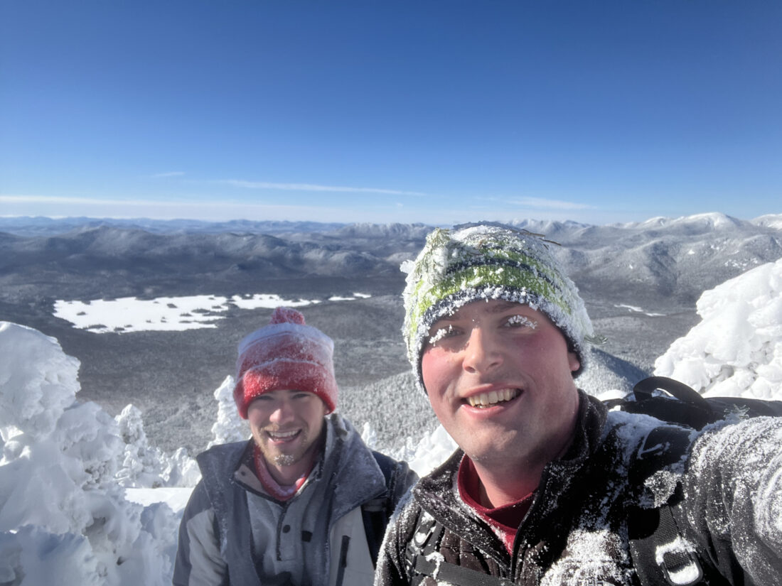
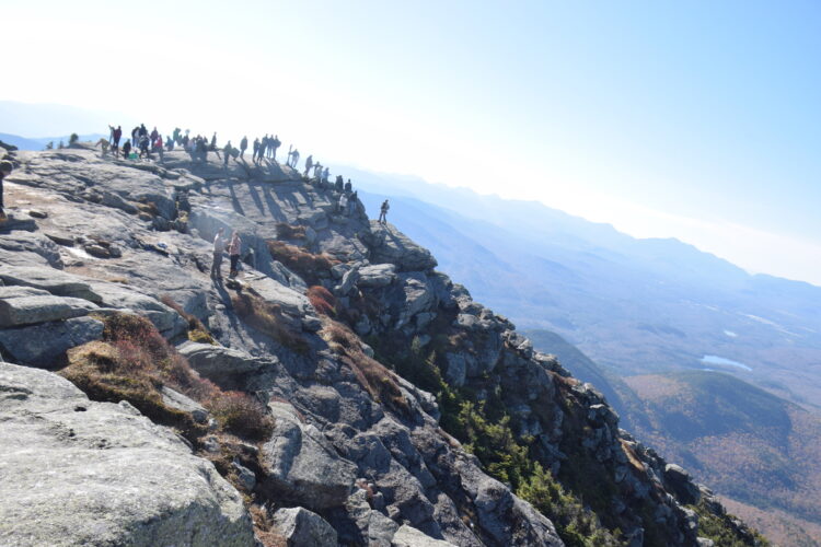
Austin Davis, left, and Chris Gaige smile atop Macomb Mountain in the town of North Hudson on Friday, Jan. 16. (News photo - Chris Gaige)
ELK LAKE — It was an inertia I had seldom felt before.
I wasn’t out of breath, my muscles didn’t feel sore (yet) and I wasn’t chilled. Yet, every step felt like lifting a cinder block out of mud. For one reason or another, physical, mental or both, I stood totally sapped of energy, or so it seemed.
All I could do was lift a snowshoe, pause for at least 10 seconds, and muster another — a pace you might assign to climbers donning oxygen masks above the Hillary Step on final approach to Everest’s summit.
This was no Himalayan ridge line. In fact, we hadn’t even cracked 3,500 feet, and it was much closer to home. On Friday, Jan. 16, my cousin, Austin Davis and I were trudging our way up the base of the Macomb slide, attempting to reach the mountain’s 4,405-foot summit that seemed, at that point, miles above, tucked behind an unrelenting slope that stood in front of us.
Trail conditions were brutal up to that point. Macomb is one of the unmarked High Peaks, and while this term is a bit of a misnomer today in that the routes are so frequently traveled, an established path through the woods takes shape. The term, however, comes closer to its true meaning in the winter when the ground is uniformly blanketed in snow and there is no tracks to follow.
Being a Friday, we suspected it had been a few days, or more, since anyone else had been up to Macomb. To our pleasant surprise, we had a faint track from the trailhead to follow. The first 2.3 miles of the trail is marked and easy going, with slight ups and downs (4.5 miles in the winter, as the immediate trailhead parking lot is closed, and requires an additional 2.2 mile trek along an access road).
After that stretch, the trail comes to a junction with the unmarked Macomb trail, while the main route continues on to Dix Mountain. Turning right toward Macomb, we found that the trail instantly became looser, an indicator that it was less trafficked, as the snow underneath wasn’t as packed.
We still had whispers of a track, but it was getting more elusive. The next 1.2 miles was the lead-up to the slide. The incline had increased, and we had lost the trail in a couple places, requiring some backtracking and eagle eyes to pick up where we fell off the packed trail, usually a sudden turn around or through thick brush.
When we hit the base of the slide, the tracks completely disappeared. We had expected as much. The open slide is far more susceptible to wind drifting than the surrounding forest. Any tracks up it would be covered much quicker.
Furthermore, as we gained elevation — we entered the slide at around 3,300 feet, about 1,000 feet higher from the split-off with the trail to Dix — the snowpack grew dramatically. We took informal measurements with our trekking polls. It was between three and four feet on the slide.
With waist-deep snow and no path to follow, we pressed on, with Austin doing the heavier lifting going first. The slide became steeper, and the momentum slowed. The aforementioned inertia took full control. It wasn’t all doom and gloom — quite the opposite, in fact.
It was a beautiful, blue bird sky winter day. The wind was light and we were basking in the sun. As we slowly made our way higher, the surrounding backdrop was stunning, a glorious panoramic view of Mount Marcy — the tallest mountain in the state at 5,344 feet — and more than a dozen surrounding High Peaks.
And despite the molasses pace, it was still fairly early in the day, and we remained far from our turnaround time. Austin and I originally planned to tack on two more nearby High Peaks, South Dix and Grace, to this hike, though it was becoming clear on the slide that we wouldn’t have time for those. This was a contingency we had anticipated and accepted.
Macomb made for a nice fail safe, as those other two mountains have more direct access paths, avoiding the need to re-summit Macomb when we, hopefully, come back for South Dix and Grace.
Given the pleasant weather conditions for the day, we also knew that if we did become lost off-trail, we could simply turn back and follow our snowshoe tracks, a luxury unavailable in the summer months when it’s harder to see where you just walked. Going back down Macomb, we knew, would also take much less time than the ascent.
So between the nice weather, time management and full slate of winter gear we carried, Austin and I felt at ease. Many smiles were had staring at the surrounding mountains and lakes between steps.
Looking back, I could very easily see how the lack of any of those factors, combined with our molasses pace, tough terrain and the absence of a trail in front of us could have set us in a state of panic, or at least distress.
It was a reminder to me that winter hiking epitomizes the balance of such beauty as the day we had before us, and the inherent and cascading dangers when something goes wrong, especially when unanticipated. It’s a balance that, among other things, demands proper planning, knowledge of the route and a willingness to call it and turn back or modify the itinerary.
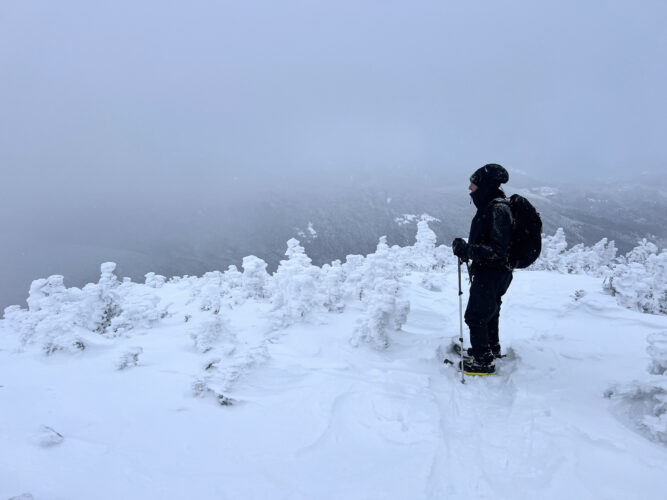
With our sights set on Macomb, we made it to the top of the slide — not quite the true summit — and reentered the forest, finding remnants of a track, and presumably continuing our trail breaking in others. We were only 400 vertical feet and a few tenths of a mile from the summit, as measured by my GPS-tethered watch.
The going remained slow. The snowpack seemed in excess of four feet, and we had to be careful to avoid “spruce traps,” pockets of air that form as snow accumulates around pine bows, creating sink holes that are easy to fall into. Sometimes they’re undetectable, as short-growing summit-area evergreen trees can be completely under the snow. In general, though, we kept our distance, the best we could, from pine trees, still managing to pick up a few sinks along the way.
At long last, or 5 hours and 55 minutes to be more precise, we reached Macomb’s summit — unsure at first if we were in the right place. Further inspection revealed the summit sign to be encased in a half inch or so of ice, barely visible from the tree it’s nailed to. We brushed it off the best we could, took our photos and admired the view.
We didn’t stay for long, largely because the 180-degree summit vista was generally the same view to be had from the slide, of which we enjoyed plenty. Suffice it to say, it was much easier following our tracks down. Austin and I laughed seeing how quickly we covered ground that had taken so long to gain on the ascent.
We got back to the slide. It was time for the best part of the day — sitting down and butt-sliding down the steep terrain. We wooshed down, like a wintertime amusement park ride, getting one last chance to soak in the views before we were back into the woods.
The hike out from there was largely uneventful, but it was a psychological hurdle. The initial 4.5 miles that felt like such a breeze in the morning now dragged on, and on. As much fun as the day had been, the access road on the way out was a never ending monotony, it felt twice as long, if not more, than how I remembered it in the morning.
Finally, though, we rounded the final corner to see the winter parking lot signs. Euphoria returned, the end was in sight. Austin and I said our goodbyes, and headed on our ways. We began the hike at 6:42 a.m. and finished 9 hours and 33 minutes later at 4:15 p.m., just as the woods were growing dim. Though we had headlamps with us, it was a welcome relief to not need to use them, at least this trip. The total distance, including our retracing at points where we had stopped off trail, was 13.68 miles, along with a total ascent of 4,413 feet.
It was my first winter hike of the season. Aside from not having the luxury of a well-packed trail all the way to the summit, it was hard to ask for better conditions. Though I hope it goes without saying at this point that anyone contemplating this hike should have ample preparation, physical ability and backcountry experience, Macomb and its slide offer phenomenal views for those looking for the challenge. While it’s often hiked together with some or all of the other High Peaks in the Dix Range — South Dix, Grace, Hough and Dix — Macomb as a stand alone destination was nothing short of a backcountry adventure delight.
Visiting Lake Placid
VISITING LAKE PLACID : A different world: A winter climb up Mount Colden
KEENE — My heart pounded, not from the 2,500 or so feet we had ascended over the last couple of hours, but for ...
VISITING LAKE PLACID: Rolling out the red carpet to Dix Mountain
VISITING LAKE PLACID — Sliding to completion
VISITING LAKE PLACID: Peak peace & crowds
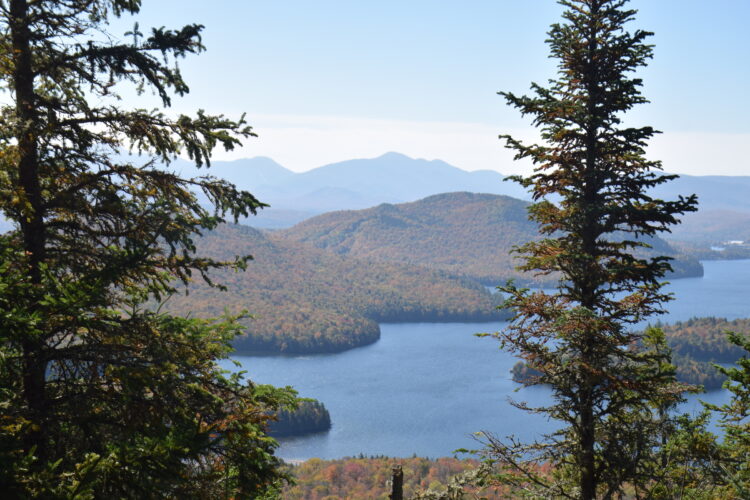
VISITING LAKE PLACID: Fleeting fall colors from Flume Knob