Breaking down the B’dale Bog Trail
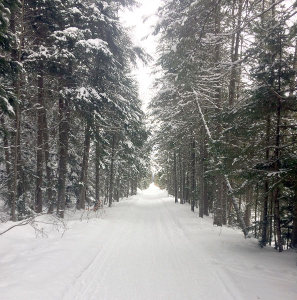
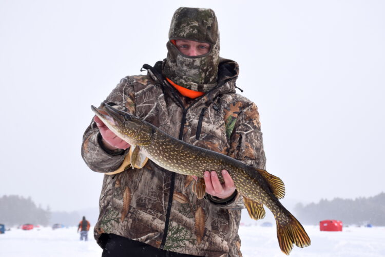
The Bloomingdale Bog Trail passes through a number of different forest types, including close-growing conifers. News photo — Justin A. Levine
SARANAC LAKE – The Bloomingdale Bog Trail is a snowmobile trail that is also popular with cross-country skiers, fat tire bikers and walkers during the winter, when snowmobile grooming keeps the trail in good shape.
Stretching 8.25 miles from its start near Saranac Lake to its end in Vermontville, the Bog Trail can also be split into five sections, ranging in distance from just over a mile round-trip to six miles. Of course, the whole thing can be skied in one shot, but be warned that there is unlikely to be any parking at its terminus near Onchiota.
—
Saranac Lake to Two Bridge Brook
The Bog Trail starts out at a small parking area on a private driveway and proceeds roughly north through the bog itself. The trail is actually an old railroad bed, so it’s flat and straight for the entire length of the trail.
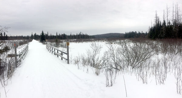
Two Bridge Brook is a good landmark between two different access points. News photo — Justin A. Levine
The upshot of skiing a flat, straight trail is that there are long sight lines, meaning you should be able to spot a snowmobile from quite a ways off. The Bog Trail is nice because it’s groomed for snowmobiles. There’s no track set, but even in a winter with deep snow, the trail remains fairly easy to ski. It’s also plenty wide, so towing a small trailer with a kid or two in it is easily do-able.
Along this first section, there are open views to the east and west, including views of Harrietstown Hill, and of the wide open bog itself.
At just about three miles, there is a snowmobile bridge that crosses Two Bridge Brook, which is hard to say five times fast. At almost exactly six miles round-trip, this is the longest stretch of the trail.
—
Two Bridge Brook to County Road 55
If you’re still feeling good after skiing three miles, you can continue on less than a mile to County Road 55, otherwise known as the Bloomingdale-Gabriels Road. Or, if you only want to sneak in a quick ski some afternoon, then go to the parking areas on County Road 55.
From Saranac Lake, go six miles on state Route 86 and then turn right onto Split Rock Road. Go 0.4 miles to the end and turn right onto the Bloomingdale-Gabriels Road. Proceed 1.7 miles to where the Bog Trail crosses the road, and park on either side. Just be sure not to block the gates or the trail itself.
From County Road 55, you can ski south to Two Bridge Brook, which is only 0.9 miles from the road. Along the way, gray jays, chickadees and other birds abound.
—
County Road 55 to Bigelow Road
Bigelow Road is a dirt town road that used to connect Oregon Plains Road to the Bloomingdale-Gabriels Road, where a decrepit bridge makes Bigelow pretty much useless for cars. However, snowmobilers utilize the road on a regular basis.
From County Road 55, ski north for less than three-quarters of a mile to where Bigelow Road crosses the Bog Trail. You will see the remains of the old bridge, along with great views of the wetland there. You could also go to the Oregon Plains Road end of Bigelow and ski about a mile west to reach the Bog Trail.
—
Merrill Road to Bigelow Road
The last spot to park along the Bog Trail is on Merrill Road, a dead-end dirt road off Oregon Plains Road in Vermontville. From the four-corners in Bloomingdale, take Essex County Road 81 one-tenth of a mile and stay straight on Oregon Plains Road. Follow Oregon Plains Road for 2.9 miles to Merrill Road on the left. Then go another half mile to where the trail crosses the road. There is usually parking for a couple of cars plowed out on the left just past the trail.
From Merrill Road, you can ski south for two miles to the intersection with Bigelow Road. This stretch of woods alternates between close evergreens and open wetlands. About a mile in, there’s a bridge and often lots of small animal tracks, such as beaver and squirrel. For a longer ski, just continue to the Bloomingdale-Gabriels Road for a 5.4-mile round-trip.
—
Merrill Road to Oregon Plains Road
This last stretch of the trail can be a little deceiving since the snowmobile trail continues past Oregon Plains Road and on into the state’s Buck Pond Campground and the Lake Kushaqua area. But the part of the trail between Vermontville and Onchiota is privately owned and open only to snowmobiles. There is also no parking at the Oregon Plains end of the trail.
From Merrill Road, ski north through what feels like the darkest part of the trail. Lots of young-ish evergreens crowd the sides of the trail, even though it’s still about six feet wide. Round-trip from Merrill Road to Oregon Plains Road and back is 3.3 miles.
The nice thing about the Bloomingdale Bog Trail, beside the variety of distances that can be enjoyed from various entrance points, is that it’s often in excellent shape, thanks to the snowmobile groomers. So if you do encounter snowmobiles, be sure to step off the side of the trail and let them go past with a smile and a wave.
- The Bloomingdale Bog Trail passes through a number of different forest types, including close-growing conifers. News photo — Justin A. Levine
- Two Bridge Brook is a good landmark between two different access points. News photo — Justin A. Levine
Outdoors
VISITING LAKE PLACID : A different world: A winter climb up Mount Colden
KEENE — My heart pounded, not from the 2,500 or so feet we had ascended over the last couple of hours, but for ...
Forest ranger recalls saving hiker lost for two days in Dix Range
Snowshoer found dead in lean-to in Pharaoh Lakes Wilderness
SCHROON — A Florida man was found dead in a lean-to in the 44,400-acre Pharaoh Lakes Wilderness in southern Essex ...
DEC proposes changes to coolwater sportfish regulations
State Police release name, cause of death for Marcy hiker