What’s with the weather?
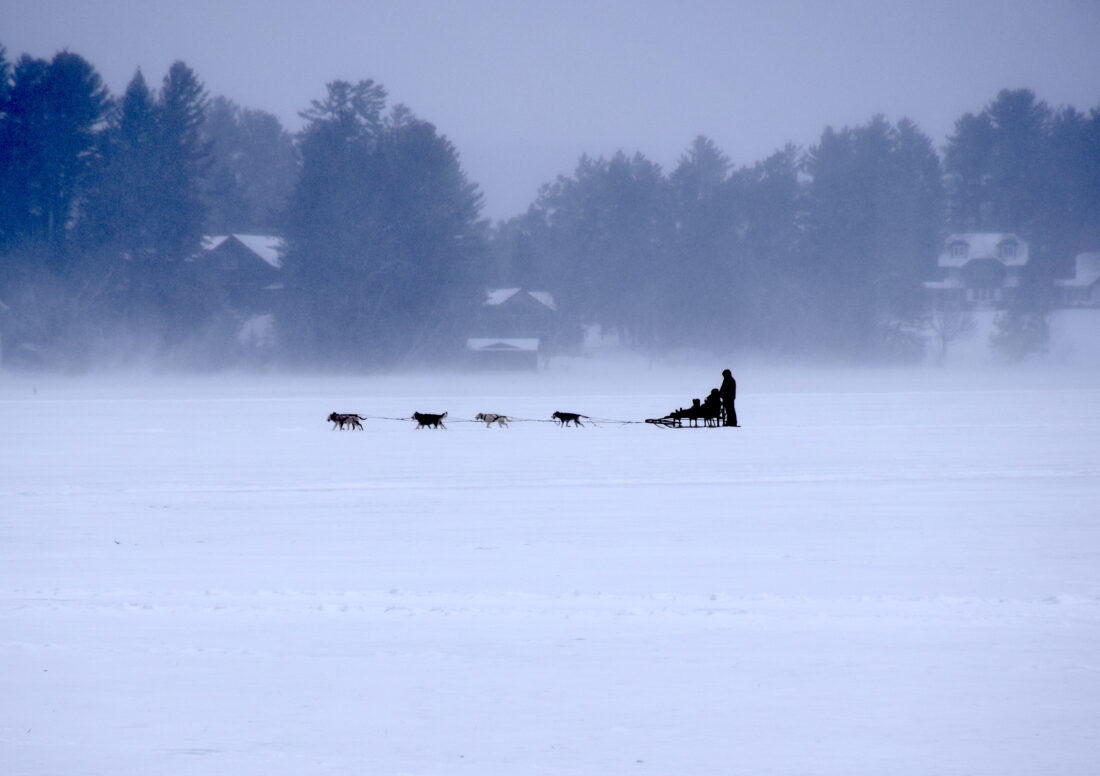
A dog sled makes its way across Mirror Lake under snowy and windy conditions on Tuesday, Dec. 30. The wintry pattern that dominated much of Decemeber is expected to remain in place, at least through early January. (News photo — Chris Gaige)
LAKE PLACID — The script has been flipped, at least so far this winter season.
With no shortage of marginal starts to previous winters in the Adirondacks, the cold and snowy December — a weather pattern that is expected to persist into at least early January — has been a welcome throwback for winter sports lovers and those who rely on winter-driven tourism to the Olympic region.
Meanwhile, much of the western U.S. has been gripped with persistent above-average temperatures, and, in some places, the lowest snowpack in a quarter-century. As reported by Powder Magazine, around a dozen major western ski resorts had to push their opening days from mid or late November to early December, or later.
This comes as most major Northeast ski resorts — including the three operated by the state Olympic Regional Development Authority, Whiteface, Gore and Belleayre — had their lifts spinning the weekend before Thanksgiving, two weekends before in Whiteface’s case.
It’s an anomaly — East Coast resorts typically lag behind their western counterparts in opening day and early-season coverage — that was evidenced, perhaps most prominently in the ski world, when International Ski and Snowboard Federation (FIS) announced that it was moving two World Cup competitions that were slated for Utah’s Deer Valley to Lake Placid and Waterville Valley, New Hampshire.
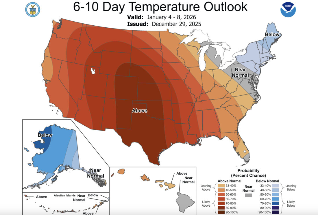
The National Weather Service’s temperature outlook for Jan. 4-8, issued on Dec. 29, predicts above-average temperatures over much of the western and central U.S. while the Northeast is expected to remain below average. (Provided photo — National Weather Service Climate Prediction Center)
The reason for the move was pretty clear.
“Insufficient snowpack and persistently warm temperatures, which are expected to continue into early January, have significantly impacted snowmaking efforts,” FIS said in a statement announcing the move. “Given the substantial snow volume, infrastructure, and operational resources required to safely deliver a World Cup caliber moguls and aerials venue, current conditions do not allow the event to be delivered at Deer Valley to the standards required for elite international competition.”
The pattern at hand
Local meteorologist Scott McKim — the science manager at the Atmospheric Sciences Research Center’s Whiteface Mountain Field Station — said, as is often the case in weather, there’s a myriad of factors that have produced this pattern.
Put simply, McKim said it boils down to the fact that the weather pattern around the North Pole the last month or so has made it easier for frigid Arctic air to dislodge from the northernmost reaches of the hemisphere, and make its way down to the mid-latitudes.
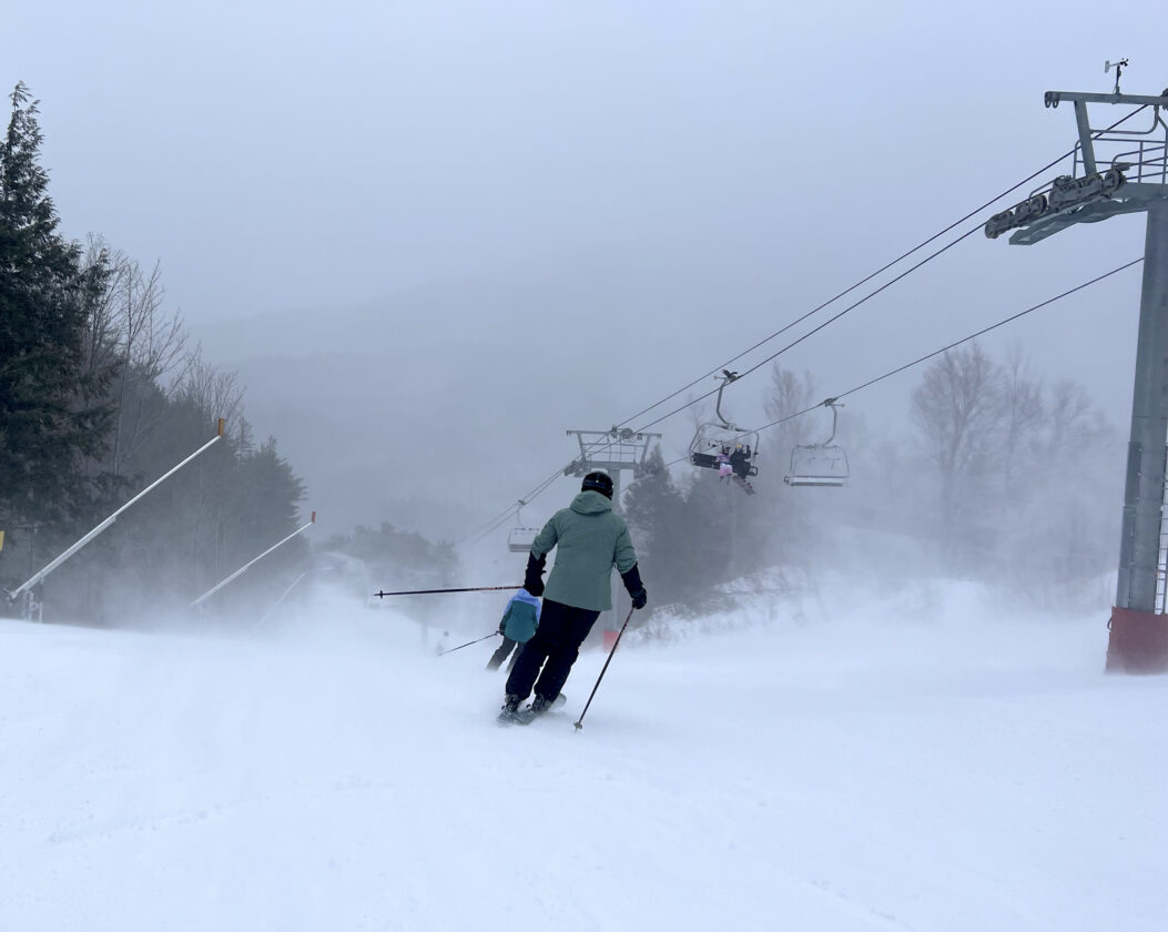
Skiers make their way down the Boreen trail at the Whiteface Mountain ski area on Tuesday, Dec. 30, as fierce winds whipped up clouds of snow. Though the ski area and its snowmakers welcome the cold weather, the strong winds that day forced many of the lifts to remain on wind hold throughout the day. (News photo — Chris Gaige)
The polar vortex is a term frequently thrown around in weather. Though it may sound scary, it doesn’t really impact the weather at the surface level, at least directly. Rather, it’s an upper-atmosphere area of low pressure around Earth’s poles that essentially acts like a rubber band for retaining cold air there. A strong polar vortex, ironically, tends to spell warmer weather in our area, as the cold stays bottled up to our north. A weak Polar Vortex, much like a loose rubber band, means that cold air can make its way south, leading to a more wintry pattern.
“One piece of this puzzle is the polar vortex,” he said. “Instead of all the cold air being wrapped up at the poles, it’s a super volatile system where we now have these lobes of cold air stretching down equator-wards around the Northern Hemisphere.”
McKim said that cold air on the loose isn’t — by itself — enough to cause cold conditions here, as the cold air could simply have been redirected elsewhere in the mid-latitudes.
“This could be very different,” he said. “We could be in this amplified pattern where the Polar Vortex is (weak), but the cold air could be draining into the west, but we’ve had a setup where it hasn’t.”
This is where the other large piece of the puzzle comes in. The jet stream — which dictates the path that the frigid air takes once it’s displaced from the pole — is set up in a way where that frigid air essentially bypasses the western U.S., and travels in a southeast flow over central Canada, making its entry into the U.S. over the Great Lakes region, then moving over the Northeast.
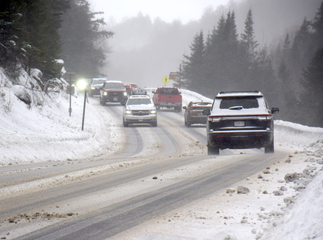
Traffic crawls through the Notch on state Route 86 near the North Elba-Wilmingtown town line under slick and snowy conditions on Tuesday, Dec. 30. The wintry pattern that dominated much of December is expected to remain in place, at least through early January. (News photo — Chris Gaige)
“The west has had a ridge most of the time, and we’re seeing staggeringly low snow amounts as a result of that,” he said. “And the opposite for the east. As a scientist, you then question, ‘Well, why is that? Why has that been the prominent setup?'”
A “ridge” refers to when the jet stream is arced farther north than usual, allowing relatively warm air to move in, and a “trough” over the east, where the jet stream sags further south than is typical, allowing the cold Arctic air to move in behind it. McKim said the entry location of this trough sets up perfectly over central Canada to essentially serve as a catch basin for the Arctic air as it exits the polar region.
“That trough has just kind of been situated along a slip plain of cold air drainage from northern Canada, where they’ve had, since early season, a pretty prodigious snowpack,” he said. “So a lot of cold air sitting there, and it just slides down the prairie provinces of Canada, over eastern Canada and then the Northeast.”
McKim said a heftier snowpack than normal over northern Canada tends to prime the cold air before it comes down east. The lack of a darker surface — as would exist without the snow — means that less heat is absorbed from the sun, allowing the air mass to more readily retain its polar chill as it takes aim at the mid-latitudes.
So why has a ridge formed over the west, and not the east? McKim said the answer lies upstream — in meteorological terms.
“That speaks to warm surface temperatures off the coast of California, the eastern and equatorial Pacific, which tends to correlate rather well with a warm west,” he said. “As that ridge builds in the west, that induces a trough in the east.”
McKim said the warmups that have taken place locally in December were short-lived “wrinkles” — only lasting a day or two before a reinforcing shot of cold air — that did not disrupt the overall trough.
Looking ahead, McKim said things could always change, but at least for the foreseeable future, the computer weather models don’t show any signs of the overall pattern breaking down, though the intermittent, brief thaws that the region experienced in December are likely to keep coming in from time to time. McKim said that the snowpack here has become durable enough to likely survive these thaws, as long as they’re not much more intense than what has been the case so far.
“I think, overall, we’re looking at a solid winter weather pattern for the East,” he said. “I think going forward, it’s kind of a plug-and-play with largely the same pattern,” he said.
Local News
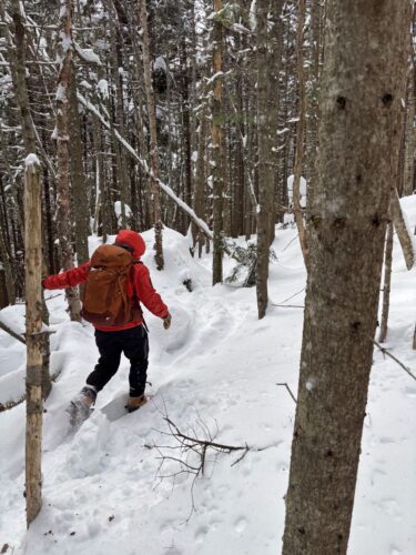
VISITING LAKE PLACID : A different world: A winter climb up Mount Colden
KEENE — My heart pounded, not from the 2,500 or so feet we had ascended over the last couple of hours, but for ...
Forest ranger recalls saving hiker lost for two days in Dix Range
Snowshoer found dead in lean-to in Pharaoh Lakes Wilderness
SCHROON — A Florida man was found dead in a lean-to in the 44,400-acre Pharaoh Lakes Wilderness in southern Essex ...
Ad’k Life announces photography contest winners
Some see Olympic blueprint for a 3rd Lake Placid games
CORTINA D’AMPEZZO, Italy — Imagine: A sprawling world-class city and a small mountain village with a rich ...