Mirror Lake sees its earliest ice-in since 2019
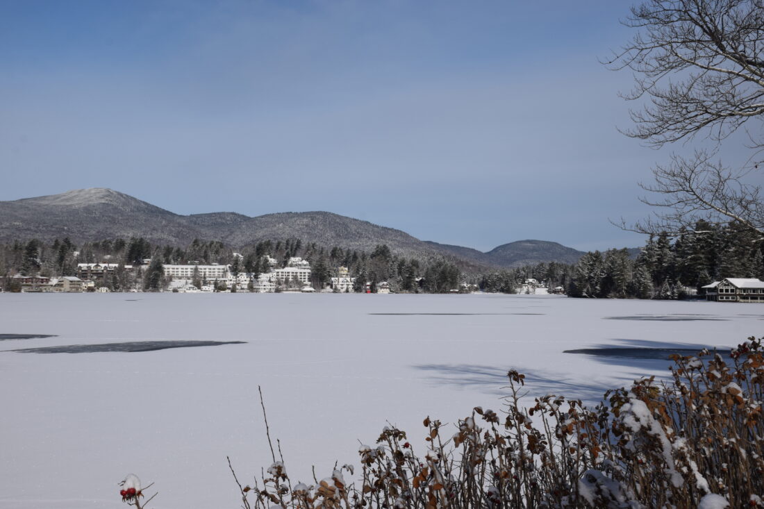
A frozen Mirror Lake is seen on Wednesday, Dec. 3 in the village of Lake Placid. (News Photo by Chris Gaige)
LAKE PLACID — Around 4:30 a.m. on Tuesday, Dec. 2, Mirror Lake lost its shine.
It was a sign. The ice was in, and the nocturnal lake’s surface no longer reflected the surrounding lights on its shore. When the sun rose a few hours later, it was visually confirmed: a thin, opaque sheet of ice had formed in front of the lake’s 24/7 live-stream camera, maintained by the Ausable Freshwater Center (AFC) and perched on the Golden Arrow Lakeside Resort.
It’s the earliest ice-in date for the lake in six years. In 2019, the lake’s recorded ice-in date was just one day earlier, falling on Dec. 1. In 2018, the lake froze over on Nov. 23. The earliest recorded ice-in since 1903, the year that Mirror Lake’s ice coverage observations began, stands as Nov. 15, 1939.
Mirror Lake has one of the longest ice records in the state. It’s not totally complete, but it’s close. In the 122 years, there have been only 11 years without known ice durations, either because the ice-in, ice-out or both dates weren’t recorded that winter season.
The Mirror Lake ice-in and ice-out dates for the previous five years are as follows:
¯ 2024-25: Ice in — Dec. 13; ice out — April 15; duration 123 days
¯ 2023-24: Ice in — Dec. 22; ice out — April 1; duration — 101 days
¯ 2022-23: Ice in — Dec. 13; ice out — April 14; duration — 122 days
¯ 2021-22: Ice in — Dec. 20; ice out — April 14; duration — 115 days (Ice first formed on the lake on Dec. 9, melted on Dec. 12 and then froze over on Dec. 20.)
¯ 2020-21: Ice in — Dec. 16; ice out — April 9; duration — 114 days. (Ice first formed on the lake on Dec. 11, melted later that day and the next, then froze over on Dec.16)
Since 2015, the AFC has maintained the record. The organization defines ice out as Mirror Lake being navigable from one side to the other, meaning that the days where the lake is partially frozen over count toward the ice cover.
Phil Snyder, the AFC’s water quality research manager, said it’s important to have such a long-running ice record. It helps to point out long-term trends. While this year’s ice-in date is earlier than most in the past few decades, the overall trend has been for later ice-in days and shorter overall ice durations as winters have tended to become warmer over the ice record period.
The average ice-in date for the entire record is Dec. 4. But when looking specifically between 2015 and 2024, the average ice-in date falls back to Dec. 12.
Although this year’s data bucks the trend, Snyder said it’s crucial to understand that while there is variation each year — with some, like this year, being on the colder side, and others, like the 2015-16 winter season when the ice didn’t form until Jan. 4 being on the warmer side — the overall trend is for less ice.
“The variations from year to year are what we consider to be weather,” he said. “The overall trend line of later ice-in dates is more of what we would consider to be the climate, the warming trend that we’re in.”
Such a claim is possible in large part because there’s such a long ice record to point to. The AFC notes on its website that, despite Mirror Lake routinely exceeding 150 days of ice cover during the first half of the record, 19 of the 56 recorded years in that timeframe, 1995 remains the only recorded year that has exceeded 150 days of ice cover on Mirror Lake since 1978.
Although the lake is frozen, the ice remains thin, and venturing onto the lake’s surface is not recommended this early in the season. The ice’s thickness is expected to grow this week, as below-average temperatures are expected to remain in place across the Olympic region for much of this week, according to the National Weather Service’s Burlington, Vermont office, which serves the area.
As of press time Wednesday, Dec. 3, NWS Burlington forecasted that every daytime high temperature through Tuesday, Dec. 9, will remain below freezing, with some overnight low temperatures below zero predicted. The office added in its forecast analysis that there will be several opportunities this week for light to moderate snowfall, though it remained too far out to predict with much certainty how much snow will fall in Lake Placid.
Local News
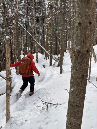
VISITING LAKE PLACID : A different world: A winter climb up Mount Colden
KEENE — My heart pounded, not from the 2,500 or so feet we had ascended over the last couple of hours, but for ...
Forest ranger recalls saving hiker lost for two days in Dix Range
Snowshoer found dead in lean-to in Pharaoh Lakes Wilderness
SCHROON — A Florida man was found dead in a lean-to in the 44,400-acre Pharaoh Lakes Wilderness in southern Essex ...
Ad’k Life announces photography contest winners
Some see Olympic blueprint for a 3rd Lake Placid games
CORTINA D’AMPEZZO, Italy — Imagine: A sprawling world-class city and a small mountain village with a rich ...