VISITING LAKE PLACID: Peak peace & crowds
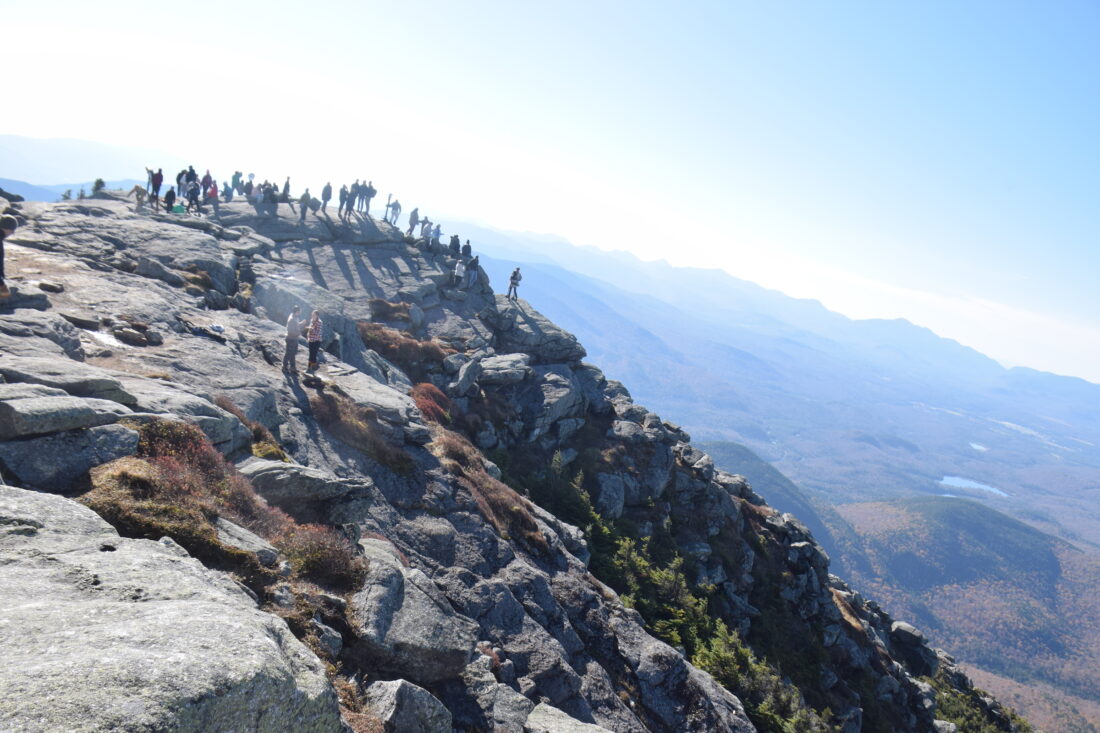
Crowds are seen atop Whiteface Mountain on Saturday, Oct. 11. (News photo — Chris Gaige)
WILMINGTON — “You know you could have just driven up, right?”
Right.
That Q&A, or variations of it, is a time-honored tradition for hikers summiting Whiteface Mountain when its Memorial Highway is open, especially during a busy holiday weekend.
Motorists’ reactions tend to range from marvel to amusement to pity as they catch sight of sweaty hikers with their bulky framepacks inching their way up the ragged rocky ridgelines on the final approach to Whiteface’s 4,867-foot summit.
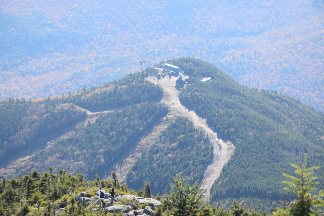
The mountain is quite unique from other High Peaks in that, at least near the top, it’s far from wilderness. Besides the ski resort below — boasting the largest vertical drop east of the Rockies — the summit is served by the Whiteface Veterans’ Memorial Highway, an attraction that saw 106,734 visitors drive up during the 2025 season. It offers an accessible and sweat-free way to take in the breathtaking views up top.
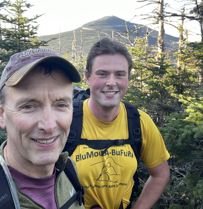
Rob Thomas, left, and Chris Gaige smile for a selfie near the summit of Esther Mountain, with Whiteface Mountain's prominent summit in the background on Saturday, Oct. 11 in the town of Wilmington. (Provided photo — Rob Thomas)
Then, for those willing and able, there are the hiking trails.
Whiteface is accessed from two primary approaches: Connery Pond and Whiteface Landing to the mountain’s west and Wilmington to the east. There are two trailheads from the Wilmington area that converge atop Marble Mountain: one from the state University of New York Atmospheric Sciences Research Center’s Whiteface Mountain Field Station, and the other from Reservoir Road.
The ASRC field station is the most popular approach. Not only is it the shortest route to the summit, but it offers the highest starting elevation at about 1,980 feet, compared to starting elevations of about 1,283 feet at the Reservoir Road trailhead, about 1,660 feet at the Connery Pond trailhead and 1,857 feet at Whiteface Landing, which can either be accessed by hiking in from Connery Pond or by boat from Lake Placid.
The ASRC and Reservoir Road trailheads are also more convenient for those looking to add Esther Mountain to the trip, the northernmost High Peak with an elevation of 4,240 feet. Esther is climbed as an out-and-back trail that intersects the trail to Whiteface en route and is on the “Wilmington side” of Whiteface, meaning its on the way when starting Whiteface from the ASRC or Reservoir Road.
For those starting and ending from Connery Pond or Whiteface Landing, on the other hand, getting to Esther would require going up and over Whiteface’s summit, down to the trail to Esther, up Esther, down Esther, back up Whiteface, then back down to Connery Pond.
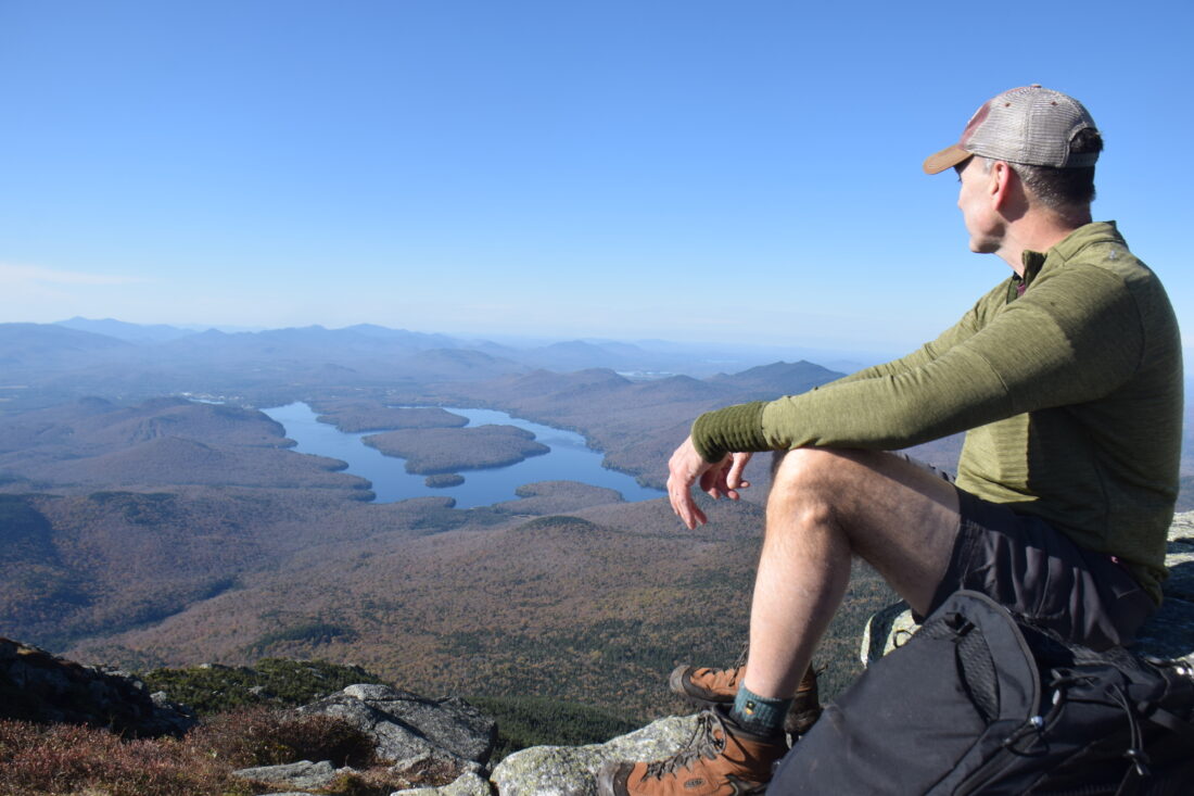
Rob Thomas looks on at the summit of Whiteface Mountain with Lake Placid below on Saturday, Oct. 11. (News photo — Chris Gaige)
Given its (relative) convenience, the several times I had hiked Whiteface and Esther before all originated on the Wilmington side. Fortunately for this hike, I was able to get the best of both worlds. I was joined by my uncle, Rob, and having two vehicles, we were able to run a shuttle and have different starting and ending points.
We left one car at the Connery Pond trailhead, which would be our endpoint for the day. We then drove east to the ASRC to begin. Our plan was to ascend Esther, head over and up Whiteface, then trek down to Connery Pond and drive back to the ASRC for the other car.
We began at 6:30 a.m. on Saturday, Oct. 11 under the glow of headlamps. There were already a dozen or so cars at the ASRC, many, I suspect, began several hours earlier to catch the sunrise atop Whiteface.
The trail, in my opinion, has one of the most demoralizing starts in the High Peaks. Why? The reasons are twofold. First, the trail goes downhill 150 or so feet right at the onset, an instant loss that you know you’re going to have to make up.
Then, it’s straight up. The trail follows the remnants of a ski lift line. The long view ahead means you’re staring down all of the uphill in front of you at once. I found that to be more psychologically daunting than the twists and turns that accompany most ascents along High Peak trails, hiding the ascent that’s around the corner in front of you and boosting the “one step at a time” mentality — even if it’s the same amount of uphill in the end.
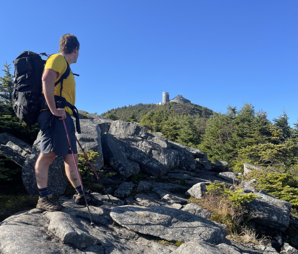
Chris Gaige looks toward Whiteface Mountain's summit while hiking on Saturday, Oct. 11. (Provided photo — Rob Thomas)
Ironically, this made hiking in the dark easier than in daylight here from a mental standpoint, as we couldn’t see far beyond our headlamps, at least at first. Daybreak soon approached, and we took our lamps off about halfway up Marble Mountain. We plodded on, and at 0.8 miles from the ASRC, the trail came to Marble Mountain’s summit — the light shone through the trees toward the end of the lift line was a much-needed sign of encouragement.
Marble Mountain was used as a ski area from 1948 to 1960, until it was abandoned in favor of the terrain that today’s Whiteface Mountain ski center occupies. Its southeast-facing summit views offered a nice break spot after gaining about 1,000 vertical feet from the ASRC, with the Wilmington Notch basking in the golden glow of the early-morning sun.
Shortly thereafter, the trail comes to a junction with the trail that begins at Reservoir Road, which is well marked with signage. From there, the uphill resumes, though it’s more of a typical weaving mountain climb than following the ski line. Though steep, there aren’t any technically demanding parts of this trail segment, and there are several other good vantage spots looking south over Bear Den Mountain.
At 1.9 miles, the grade breaks and the trail proceeds at level before coming to an intersection with the trail to Esther at about 2.2 miles. Though the trail to Esther is unmarked and not officially maintained, the trail is well-defined and we found it easy to follow.
Ironically, Esther is named after Esther McComb, at age 15, made the first recorded ascent in 1839. The story goes that she had been attempting to climb Whiteface, got lost and ended up atop the peak that now bestows her name.
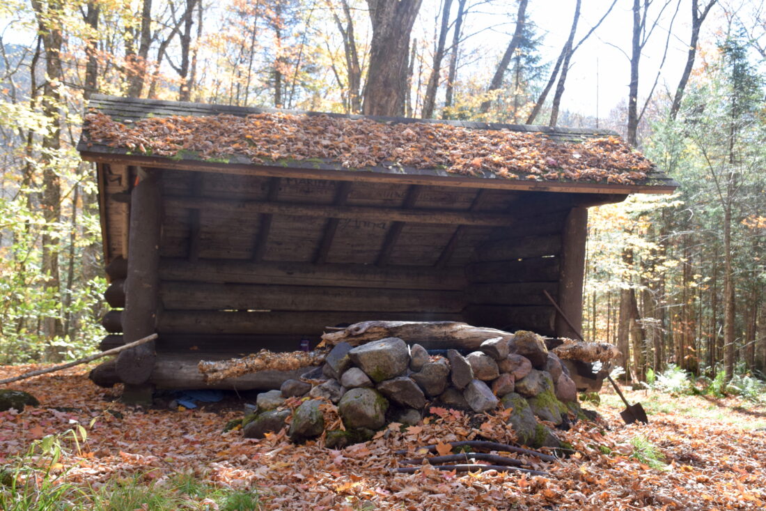
Whiteface Brook Lean To is seen on Saturday, Oct. 11. (News photo — Chris Gaige)
From the junction with the Whiteface Trail, the route to Esther climbs over the true summit of Lookout Mountain, then drops back down to the col before beginning the ascent to Esther, again, with no spots of particular technical difficulty. Esther’s summit is about 1 mile from the intersection with the Whiteface trail, making for a 2-mile total add-on with the out-and-back. Its summit is marked with a plaque and the way back offers some nice views of Whiteface’s summit.
There were a few isolated patches of ice in the shadows en route to Esther, and again on the ascent to Whiteface. Although the patches were small enough to walk around and avoid, they served as a stern reminder that winter conditions are knocking on the doorstep at higher elevations, and hikers venturing into the High Peaks this time of year should be prepared for snow and ice, and have the proper gear. A News article on that is available at tinyurl.com/39dk8nja.
Back on the Whiteface trail after returning from Esther, things remain generally level, with a few small ups and downs, for another 0.6 miles or so. The hiking trail crosses a ski trail and then comes near the unloading area of the Lookout Mountain Triple ski lift. Following that, another steep but not overtly technical ascent ensues, and the trail comes to a large rock wall that helps support the Memorial Highway above.
The trail climbs level with the highway briefly after the wall, jutting left back into the woods while the road goes straight. There’s a large boulder here that can be a bit tricky to step up, especially in the winter when it becomes iced over.
It’s a steep climb from here to the top, but the views are stunning and with the summit tower in view, there’s good incentive to make the final push. It’s one of the most scenic ascents in the High Peaks, with expansive views leading to Whiteface’s 360-degree summit.
Little Whiteface is seen from Whiteface Mountain's summit on Saturday, Oct. 11. (News photo — Chris Gaige)
As alluded to at the beginning, it was a busy day up top, with about 150 people at the summit when we arrived. There were several hiking groups that day who were finishing their 46 climbs to become “46ers,” with Whiteface making for a fitting finish on such a sunny day.
After taking a lunch break, we continued over the summit and west down to Connery Pond. This part of the trail was a bit treacherous, with numerous large rock boulders and slabs making for a tricky descent that demanded slow moving and extra time. This would be especially difficult if it was a wet or icy day by High Peaks standards, it’s not exceptionally difficult, but hikers taking on this part of trail should be in good shape and have ample hiking experience.
The trail mellowed out once below the tree line. Its incline gradually leveled and at 8.6 miles (6.6 excluding Esther) we reached the Whiteface Brook lean-to. From there, it was an easy hike out to Whiteface Landing and the Connery Pond trailhead.
Knowing it’d likely be a busy day on the trails, we kept count from the start — we passed 76 hikers (excluding the summit crowd) and two dogs throughout the day. The Connery Pond trail was far less busy, the tranquility was a nice way to end the day.
In all, it was 12.8 miles and a total ascent of 4,085 feet. It took us just over seven hours, 30 minutes. While two cars are needed to make this trip realistic, I cannot recommend it enough for avid hikers up for a challenge.
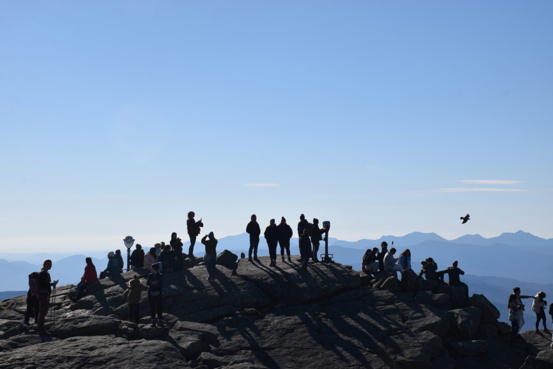
Crowds are seen atop Whiteface Mountain on Saturday, Oct. 11. (News photo — Chris Gaige)
Local News

Ad’k Life announces photography contest winners
Some see Olympic blueprint for a 3rd Lake Placid games
CORTINA D’AMPEZZO, Italy — Imagine: A sprawling world-class city and a small mountain village with a rich ...

Cheers across US after men win first Olympic hockey gold since 1980

‘I couldn’t breathe for a bit there’

Hockey boosters
Village of Lake Placid braces for high energy bills
LAKE PLACID — The village of Lake Placid is warning residents that next month’s energy bills will be even ...