VISITING LAKE PLACID: Fleeting fall colors from Flume Knob
Moderately difficult climb with rewarding views of Jay Mountain, Sentinel Range
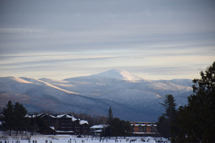
- The Sentinel Range is seen from Flume Knob in the town of Wilmington on Wednesday, Oct. 8. (News photo — Chris Gaige)
- Amber foliage and trail signs are seen at one of the intersections en route to Flume Knob in the town of Wilmington on Wednesday, Oct. 8. (News photo — Chris Gaige)
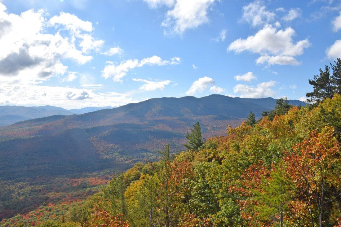
The Sentinel Range is seen from Flume Knob in the town of Wilmington on Wednesday, Oct. 8. (News photo — Chris Gaige)
WILMINGTON — It was as if I was walking on lava.
Yet, my feet were well within the range of their normal temperature. This was no eruption of molten magma, but rather the fresh fall from a grove of red maple trees above. As I made my way up to Flume Knob, there was a 10th of a mile or so where the forest floor was absolutely striking — I had never seen such pristine red ground.
Perhaps it was the way the early morning light shone through the trees? Maybe it was the rain and wind of the cold front that had lumbered through the night before, knocking some leaves down that would have otherwise dulled a bit more before falling to the ground?
Despite peak foliage having passed the Olympic Region by — as evidenced by the ground — there were still occasional splotches of color to the canopy as a few stubborn trees held on. After last week’s near-bushwack of a hike to Eagle Eyrie, I set out to catch the closing act of foliage from a pretty, but easy-to-find vantage point. That’s when Flume Knob caught my eye.
The 3.3-mile round trip (1.65 miles from the trailhead to the summit) is a huff of a climb, to be sure. The trail gains about 1,200 feet, and most of that comes in the 0.9 miles closest to the top. The trail is, however, finely marked and easy to track, even with a fresh layer of leaves on the ground.
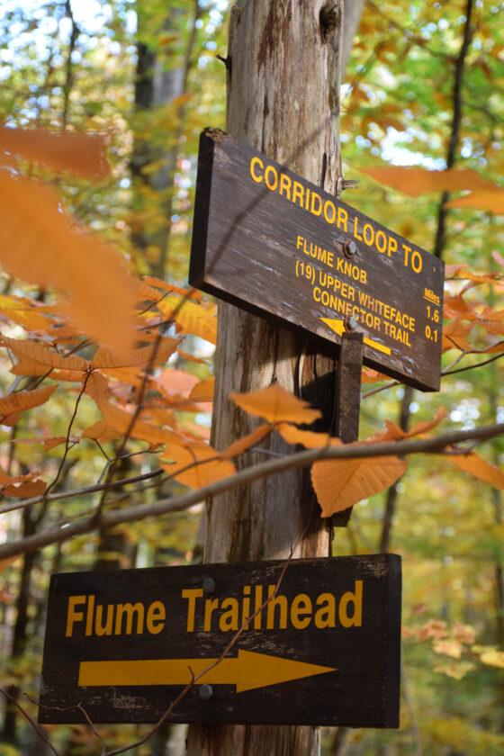
Amber foliage and trail signs are seen at one of the intersections en route to Flume Knob in the town of Wilmington on Wednesday, Oct. 8. (News photo — Chris Gaige)
Well-marked isn’t exactly straightforward, though. That’s because the trail is part of the Flume Trail Network, a system of multi-use hiking and mountain biking routes. There are several intersections along the way to Flume Knob with other network trails, most with signs clearly indicating the way to Flume Knob, but not all.
Especially for those unfamiliar with the network or heading out there for the first time, it’s a good idea to consult a map ahead of time, and maybe even print out a physical copy to reference while hiking. A map from the state Department of Environmental Conservation — the trails are public and on state land — is available at tinyurl.com/4z542fja. Though one could also save it digitally, cellphones should not be relied upon as a means of navigation when hiking in the Adirondacks.
There are two primary access points for the trail, one from the Flume Trailhead just a bit north — less than 100 feet — of the state Route 86 bridge over the West Branch AuSable River between the Whiteface Mountain ski center and Wilmington. The other is from the Bear Den trailhead parking lot at Whiteface.
To access these from Lake Placid, head east on state Route 86. The ski center’s entrance is approximately 10 miles from downtown Lake Placid. Driving into the ski center, take a right toward the Bear Den Lodge just after crossing a bridge over the AuSable River, with the main lodge visible on the left. Continue uphill as the driveway, then make a sharp left, past a large parking lot on the right. After the bend ceases, charging ports for electric vehicles come into view on the right, with the trailhead register located near those.
To get to the Flume Trailhead, continue past the ski mountain on state Route 86 for about another 1.3 miles before crossing the bridge and coming to the parking area on the left. Having recently hiked Bear Den, I decided to start from the Flume Trailhead.
–
The trail
–
From the Flume trailhead, take the Corridor Trail. Hikers might be glad to know that the trailhead distance and elevation ascent — 2.0 miles and 1,325 feet — are both overestimations, provided one takes the most direct route. The trail begins by proceeding level on a wide hiking/mountain biking shared path.
Proceed straight at the four-way intersection at 0.1 miles. Continue straight again at the intersection at 0.15 miles, avoiding the Delta Cutoff that goes off on the right. Go left, following the Corridor Trail at 0.2 miles. One of the aforementioned intersections without a sign to Flume Knob comes in at around 0.6 miles. Go left here, and don’t follow the Rock Garden Trail.
Around 0.7 miles, the trail begins climbing. It’s a gentle ascent at first, but soon turns into a steady moderate pitch. The path switches from a multi-use to a foot trail only, with a sign at 0.8 miles stating that no bicycles are allowed beyond that point. From here, the trail is marked by blue DEC foot trail discs.
At approximately 0.9 miles, the trail comes to an intersection with the route to the Whiteface Mountain ski center, which goes to the left. This is where one would pick up the route to Flume Knob if they started at the Bear Den trailhead. The junction is well marked.
Continuing toward Flume Knob, the trail continues its steady moderate ascent where I passed the iconic red leaf forest floor, providing a nice spot to catch my breath. The trail eases to a gentle climb for a bit at 1 mile as the forest changes from a mixed to predominantly coniferous. This doesn’t last long as the trail returns to a moderate to steep climb, and mixed forests return just before 1.1 miles.
As the trail gains in elevation and pulls close to a ridge line, a view begins to emerge through the trees to the right. While it was only a partial view when I climbed on Wednesday, Oct. 8, it will become more prominent as more leaves fall, as it was obscured primarily by deciduous trees.
There is a short rock scramble around 1.3 miles. As far as scrambles go, this is quite easy to navigate, with ample foot and hand holds — though I would say it’s the most difficult portion of this particular climb.
The trail continues pulling along a ridge line, offering increasingly better views through the trees, a sample of what awaits. The climbing continues at a moderate clip until it takes a sharp right at 1.65 miles to emerge at the summit, a large east-facing rock outcropping offering breathtaking 180-degree plus views of Jay Mountain, the Sentinel Range and numerous surrounding hills and smaller peaks.
Getting onto the rock outcropping is itself a bit of a scramble, similar in difficulty to the one encountered at 1.3 miles. It’s a scenic view and well worth the trip up, in my opinion. The hike back down was straightforward. As is the case with hiking trails throughout the Olympic region now, extra care should be taken on inclined terrain after rainfall. The freshly fallen leaves can retain the moisture and remain slick, creating a bit of a hazard in trail segments that otherwise offer dependable traction.
Although the hike to Flume Knob demands some agility and good physical condition, I would rate it as beginner-friendly, and recommend budgeting two to three hours of time, perhaps a bit more for those with minimal hiking experience, and vice versa for those with more.
Inexperienced or infrequent hikers looking for advice and things to consider when planning a trip would be well-advised to consult the DEC’s Hike Smart web page, available at tinyurl.com/4a9sydmh.
Local News

Meyers Taylor wins Olympic monobob title
DEC proposes changes to coolwater sportfish regulations
State Police release name, cause of death for Marcy hiker
OurStoryBridge officials appreciate recent national, local support
WASHINGTON, DC — Nonprofit OurStoryBridge Inc. is excited to announce support from three foundations and a state ...
Whiteface skier death from blunt force trauma to chest