VISITING LAKE PLACID: McKenzie Mountain: False summits, true grit
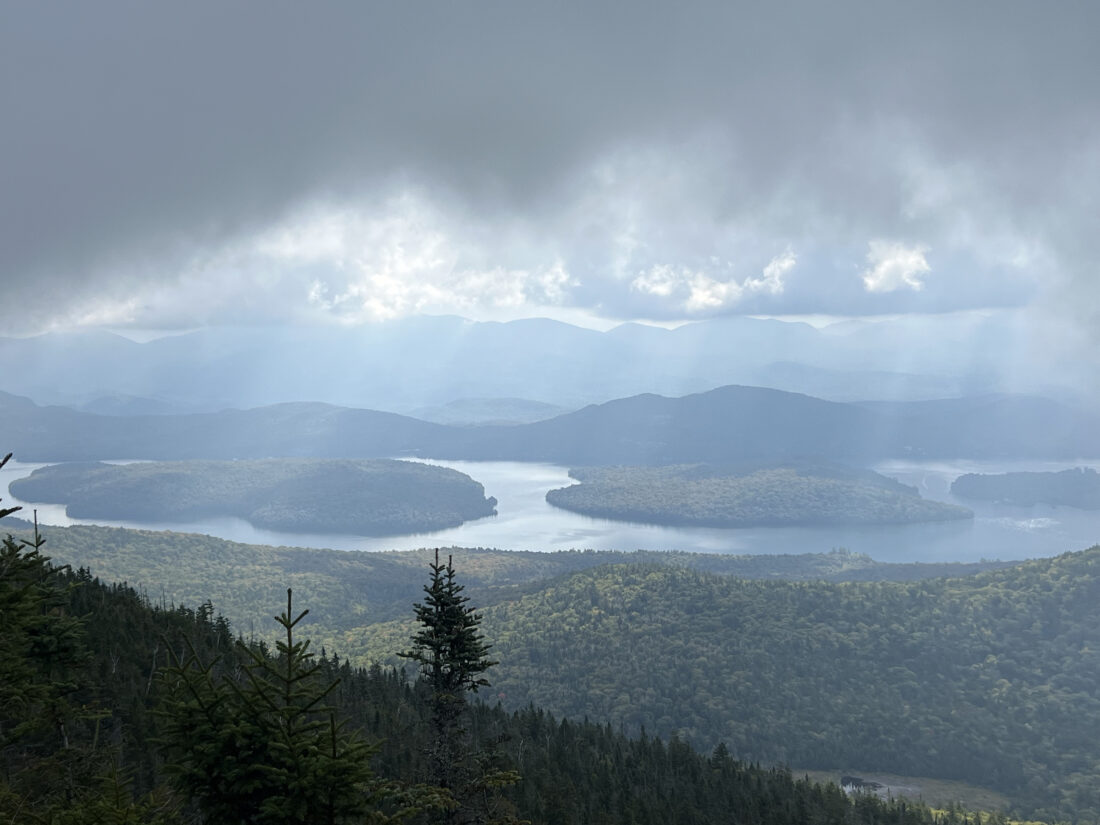
Buck Island, left, and Moose Island in Lake Placid are seen from near McKenzie Mountain’s summit as low clouds lift on Sunday, Sept. 14. (News photo — Chris Gaige)
LAKE PLACID — It wasn’t exactly a secret.
Looking up at McKenzie Mountain from the village of Lake Placid — or from Saranac Lake to its west — the first thing I realize is its distinctively jagged ridge line, a geological pain in the butt given that McKenzie Mountain’s main hiking trail seems to follow that ridge line to a tee.
The trail goes up and down and up and down and up and … you get the point. Hiking McKenzie Mountain takes mental fortitude — not just to make it up its steep ascent and tricky rock scambles — but because it feels like one has reached the summit not once, not twice, but three separate times just to have hopes dashed as the trail crests on a false summit, just to reveal a slightly higher point in the distance, the “spikes” on its ridge line as seen from down below.
Admittedly, unlike some of the other local hikes I’ve had the pleasure of chronicling for this column, McKenzie isn’t exactly a “bang for your buck” when it comes to scenic views. There are views to be had, to be sure, but they come at a steep price — literally.
The trail climbs over 2,000 feet in the span of 3.4 miles one-way. That’s not the full story. About half of that elevation gain comes in one brutal 0.4-mile section of trail that the state Department of Environmental Conservation may be well-advised to name “Elevator Shaft,” or something to that effect. Just a thought.
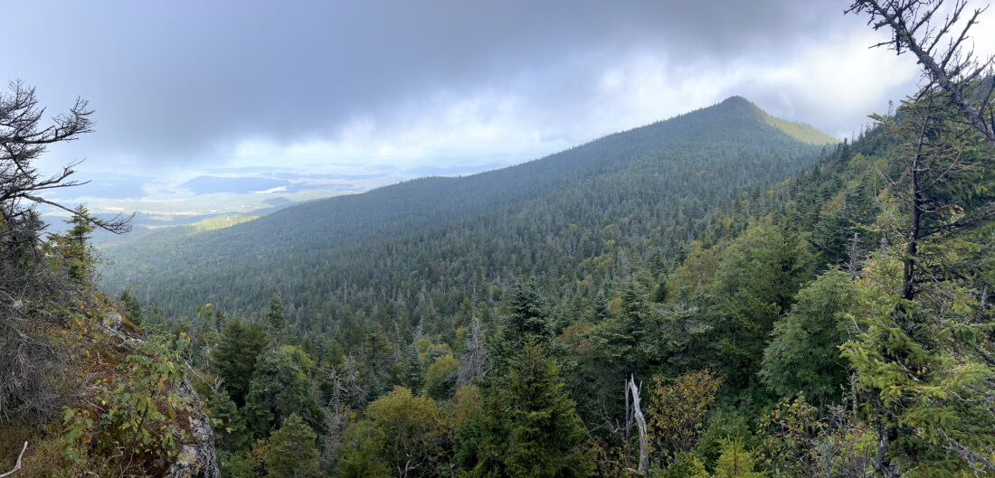
McKenzie Mountain's true summit is seen in the background at right from one of its false summits as the clouds lift on Sunday, Sept. 14. (News photo — Chris Gaige)
For those willing and able to make the climb, the views at the top are pretty neat. The actual summit is wooded, but there are several short spur trails nearby that lead to wide views to both the east and the west. Looking east, one is greeted with a fairly unique vantage on Lake Placid, the lake not the village. It’s almost a perfect side profile of the lake, its islands and its channels. To the west, there are views of the Saranac Lakes, the village of Saranac Lake and surrounding mountains and lakes. There are also spots that provide views to the southwest, where Ray Brook and some of the High Peaks.
I experienced the views in true “Adirondack style” during my hike on Sunday, Sept. 14. That is to say, the weather changed over the course of mere minutes. On the way up, the entire summit was cloaked in clouds. The lookout points were hopeless. Thinking I would miss out on the views, I was almost ready to head down when I decided to give it one more try. After all, the east-facing lookout is only about a 30-second walk from the summit.
Miraculously, the clouds began to lift and Lake Placid became visible looking down while the fleeing cloud bank was seen dead ahead at my elevation. It was like looking at a slice of the land at the atmosphere, each layer distinctly visible in front of me. Though far from the most expansive view I have ever seen in the Adirondacks, it was certainly one of the most dynamic. Sure enough, a minute or two later, the cloud bank returned and the lake disappeared.
On the way down, the clouds broke yet again and I was able to get some fleeting shots of the true summit — from a false summit, as well as some of the other directional vantage points. I was lucky to have the clouds break when they did. My stern advice is to choose a surefire, clear day to hike McKenzie Mountain. With the ascent being as grueling as it is, you’ll want to have some views to show for the effort.
–
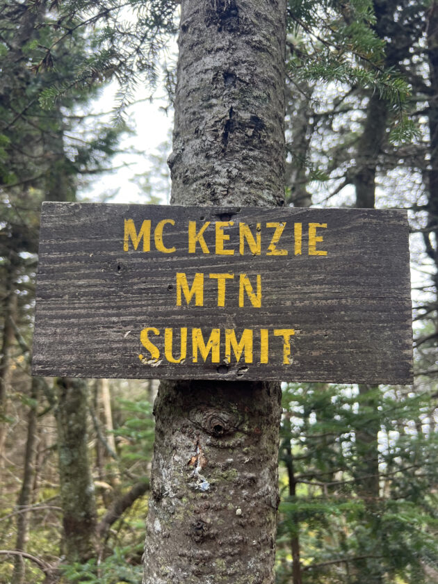
McKenzie Mountain's summit sign is seen on Sunday, Sept. 14. While the actual summit is wooded, short spur trails lead to several nearby lookouts offering better views to both the east and the west. (News photo — Chris Gaige)
The route less traveled
–
There are two trails to McKenzie. The (significantly) more used trail — and the route that I took — begins at the Jackrabbit Trail trailhead on Whiteface Inn Lane. It’s about 1.3 miles down the road from its intersection with state Route 86, on the left side. It’s a fairly small parking area and vehicles parking along the road should, as always, be sure they are not obstructing road traffic.
The other, lesser-traveled trail requires hikers to also park on Whiteface Inn Lane, and walk up Blodget Way to a metal gate, where a marked route to the side allows users on foot to bypass the gate. While the public can access this trail, there are numerous private properties adjacent to the trail near the Lake Placid shoreline, and hikers should take care to stay on the marked trail, which can be confusing to follow at times.
Hikers attempting the lesser-traveled approach should be aware that the trail is overgrown and sparsely maintained in places. Having done it once before, it’s difficult to follow and those attempting it should have ample wilderness navigating experience and be prepared for what feels more like a bushwhack at times. Though the elevation gain is less abrupt than the Jackrabbit approach, the lesser-traveled approach is still more difficult, in my opinion, and this time, I steered clear.
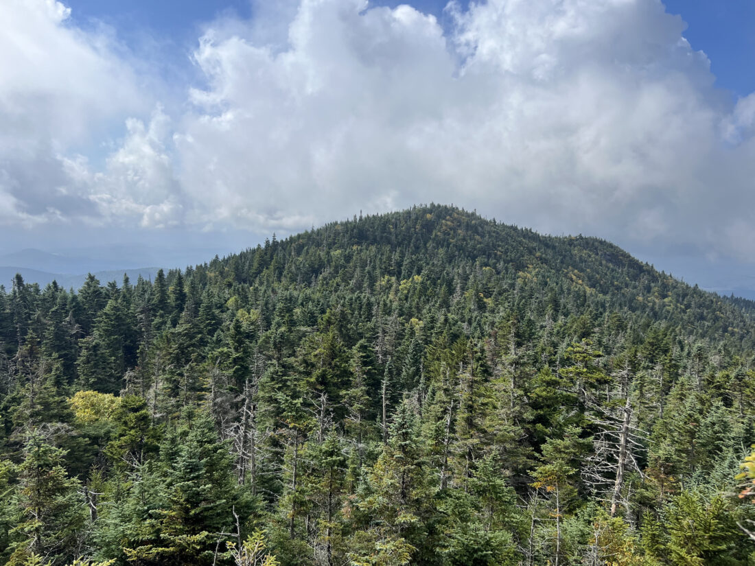
One of McKenzie Mountain's false summits is seen as the clouds lift on Sunday, Sept. 14. (News photo — Chris Gaige)
–
McKenzie via the Jackrabbit Trail
–
Beginning at Whiteface Inn Lane road, the wide trail proceeds a couple hundred feet to a sign-in register at the right, with signage providing distances to McKenzie Mountain and several other commonly-accessed destinations from the trailhead.
The Jackrabbit Trail is a popular Nordic skiing route, and the signage also provides important trail etiquette information for those using it during the winter. Most notably, skis or snowshoes are required to be worn between Dec. 7 and April 1 to avoid post-holing, which can be especially dangerous for skiers traveling at higher speeds.
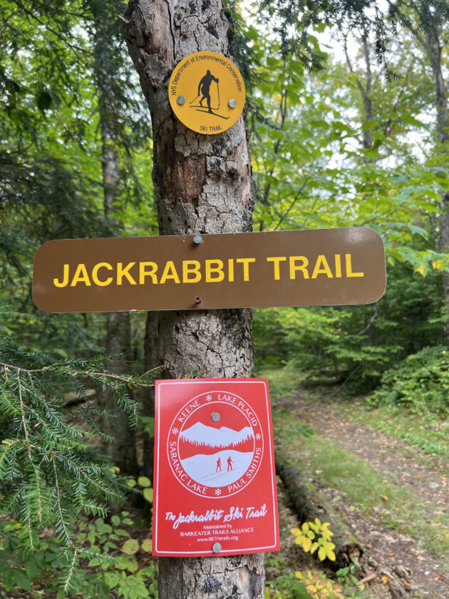
Signage is seen near the sign-in register on the Jackrabbit Trail's Whiteface Inn Road trailhead in Lake Placid on Sunday, Sept. 14. (News photo — Chris Gaige)
Continuing on, the trail climbs at a moderate, steady incline for 0.7 miles. The trail is easy to follow, though there are several private trails that come in from the sides. They are clearly marked and hikers should respect the private land.
The trail generally levels after 0.7 miles, continuing with a mixture of flat stretches or brief, gentle uphills. Ay 1.5 miles, the trail comes to the Placid Lean-to on the right. As of Sunday, Sept. 14, it was clean and well-maintained, providing a nice public camping location for those looking to spend a night along the trail.
Continuing at a level or, at times, slightly downhill grade, the Jackrabbit Trail comes to a junction with the McKenzie Mountain trail at 1.9 miles. It’s clearly marked, with the route to the summit bearing right, while the trail to the left goes to an alternative trailhead on state Route 86. Though the distance is longer, this can be a good backup route to McKenzie Mountain. Going straight at the junction along the Jackrabbit Trail eventually leads to a trail to nearby Haystack Mountain, McKenzie Pond and a trailhead at McKenzie Pond Road.
Bearing right at the junction at leaving the Jackrabbit Trail and now following red state Department of Environmental Conservation discs, conditions become rougher, as the trail is full of rocks and exposed roots. It’s still a fairly gentle uphill grade for the next 0.2 miles — then things change drastically.
At 2.15 miles, the aforementioned very steep incline begins. Unfortunately, the trail is also heavily eroded on this section, with care needed to get around some of the scraggly roots. The uphill is relentless, with a couple of rock scrambles. The toughest of which comes in around 2.5 miles. The trail takes a sharp right turn just above the scramble and can be hard to see, as there is a false path that continues straight.
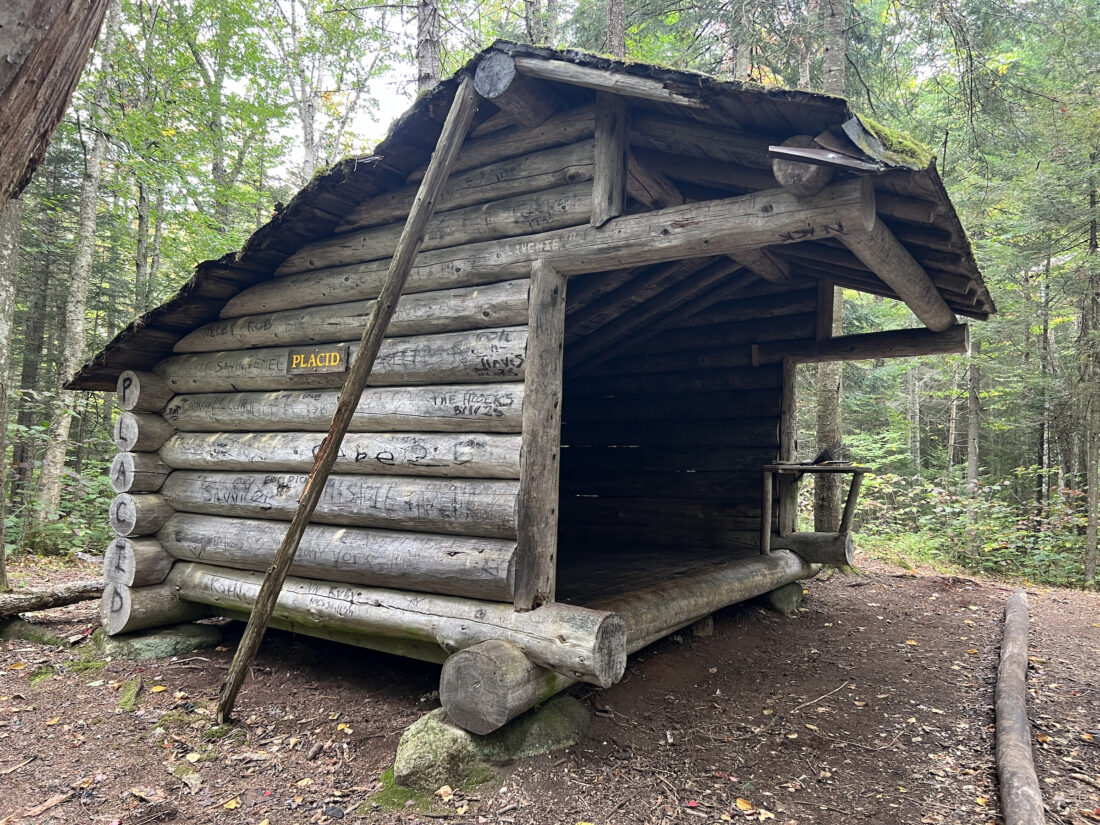
Placid lean-to is seen about 1.5 miles from the Whiteface Inn Road on the Jackrabbit Trail on Sunday, Sept. 14. The lean-to is right of the trail when walking away from Whiteface Inn Road. (News photo — Chris Gaige)
At 2.55 miles, the trail begins to level off gradually and the trail approaches the first false summits at 2.6 miles. After that crest, the trail drops down and reaches a navigationally confusing spot at 2.65 miles. The trail takes a sharp left, and there is a disc to mark it, while a false path to the right has a piece of orange-red tape around one of the trees.
The trail is generally easy-going from 2.65 to 2.8 miles as it proceeds through a col and on to the next false summit. At 2.8 miles, the trail goes left, while a well-trodden path to the left leads to a decent east-facing lookout a few hundredths of a mile away.
Continuing on, the trail comes to another false summit, with a good lookout to the west that also provides views of the true summit. It looks further than it is, and after just a few more minutes of moderate uphill — nothing like the earlier steep section — I had arrived at the McKenzie Mountain summit, as marked by a sign, around 3.4 miles.
This is where the trail meets up with the lesser-travelled route, which comes in from the east. While it’s possible to make a loop back to the trailhead by continuing on over the summit to the lesser-traveled trail, I turned around here and returned the way I came.
Taking in the views through the clouds and exercising extreme caution while descending the steeper areas, I gradually made my way back down. My total mileage was 6.9 miles, according to my GPS-tethered watch, which tends to run a bit above the officially-advertised trail mileage, as it takes into account the various meanders and lookout spur trails I took along my route.
McKenzie Mountain stands at 3,861 feet. Even though the Jackrabbit Trail begins at approximately 1,970 feet, the total elevation gain is greater than those elevational distances, given that there is some elevation loss and regain between the false summits. My watch clocked 2,369 feet of elevation gain.
All in all, McKenzie Mountain provides rewarding views, but is one of the more difficult hikes in the area. I would say it’s just beneath the caliber of difficulty for a typical High Peak, perhaps providing a worthy final test for those looking to move on to the 46 Adirondack High Peaks. McKenzie Mountain is also part of the Saranac 6er hiking challenge and, in my opinion, the most difficult of those six mountains.
For more information, visit tinyurl.com/77bj69bt.
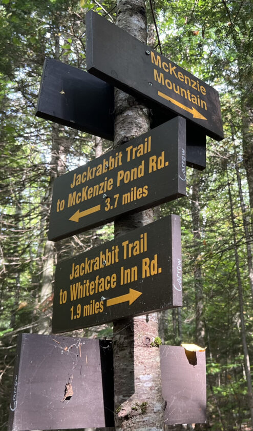
Signage marking the Jackrabbit Trail and McKenzie Mountain Trail junction is seen on Sunday, Sept. 14. (News photo — Chris Gaige)
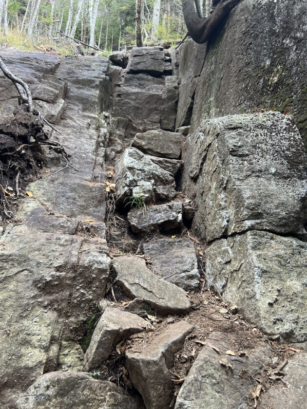
A rock scramble along the McKenzie Mountain trail is seen on Sunday, Sept. 14. The trail features several scrambles and sections of steep ascent. Hikers looking to climb McKenzie Mountain should be in good physical shape. (News photo — Chris Gaige)
Local News

Kirkby is excited to make Olympic history
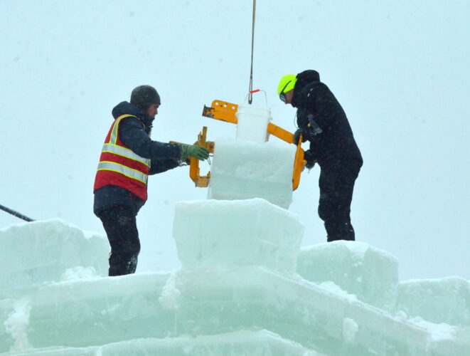
Festivities planned at Saranac Lake Winter Carnival Ice Palace
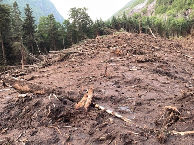
DEC plans Avalanche Pass work this summer

Lewis residents sound off at howitzer information session

2026 Milano Cortina Winter Olympics now underway