VISITING LAKE PLACID : Owl’s Head is a real hoot
- The Keene Valley is seen looking to the south from a scenic vista on the Owl’s Head trail in the town of Keene on Monday, Aug. 25. The two tallest mountains in the background are Hurricane Mountain, left, and Giant Mountain — an Adirondack High Peak. (News photo — Chris Gaige)
- The Owl’s Head trailhead is seen on Monday, Aug. 25 in the town of Keene. The trail, which is on private land, is closed from 4 p.m. Friday until 7 a.m. Monday, with public access allowed outside of those hours. (News photo — Chris Gaige)
- A steep and rocky stretch of trail is seen just before the summit of Owl’s Head in the town of Keene on Monday, Aug. 25. (News photo — Chris Gaige)
- A cliff is seen near the Owl’s Head summit in the town of Keene on Monday, Aug. 25. The trail bypasses the rock wall and winds around to the left, providing hikers a much easier path up to the summit area. (News photo — Chris Gaige)
- A panoramic view looking from south to west from the Owl’s Head summit in the town of Keene is seen on Monday, Aug. 25. Prominent mountains, from left, include Hurricane, Giant, Cascade and Pitchoff mountains. Big Slide and Cascade mountains are both Adirondack High Peaks and Hurricane has a fire tower at its summit. (News photo — Chris Gaige)
- Owl’s Head is seen from state Route 73 in the town of Keene on Monday, Aug. 25. (News photo — Chris Gaige)
- An expansive summit on Owl’s Head provides ample space for a lunch or rest break in the sun on Monday, Aug. 25. In the background is the shoulder of Cascade Mountain, left, and Pitchoff Mountain. (News photo — Chris Gaige)
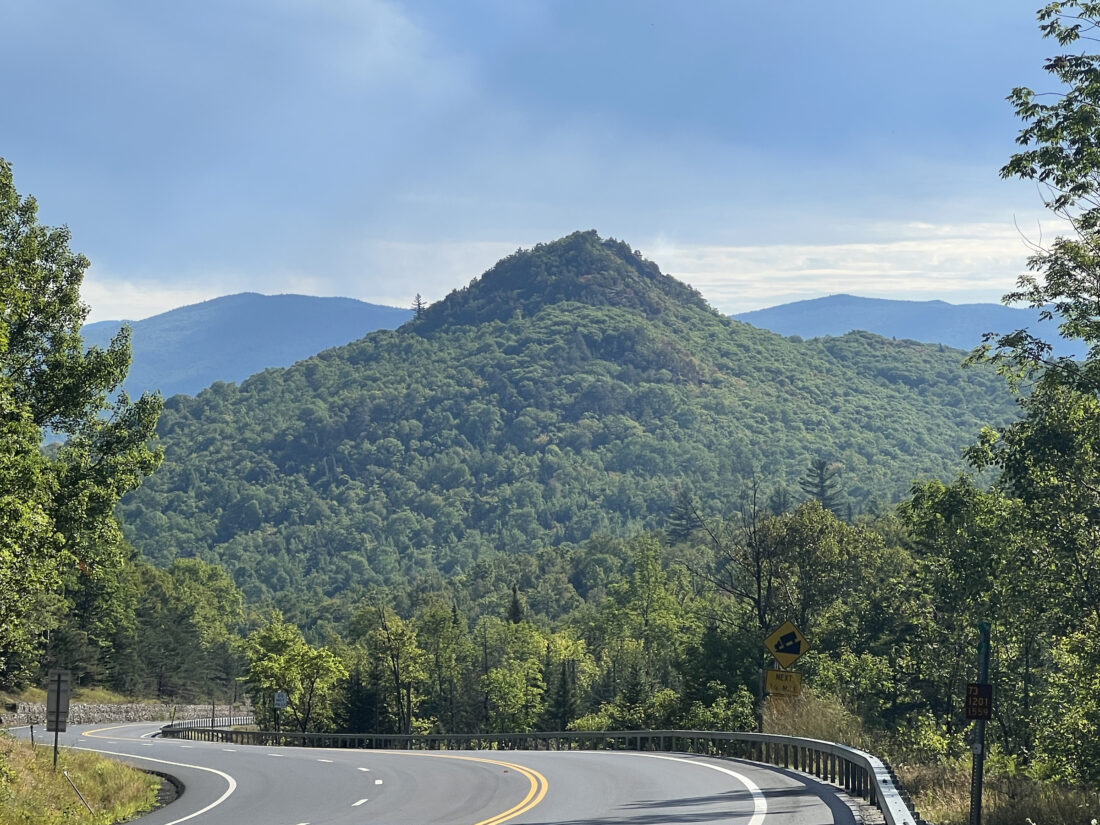
Owl’s Head is seen from state Route 73 in the town of Keene on Monday, Aug. 25. (News photo — Chris Gaige)
KEENE — Throughout the countless drives between Lake Placid and Keene heading east on state Route 73, I’ve often wondered about that small, but prominent peak that rises up right along the highway.
Its jagged rocks near the summit seemed indicative of some stellar views. On Monday, Aug. 25, I decided it was finally time to check it out. I pulled out a trail map and, knowing little about the peak, my first takeaway about Owl’s Head was simply that it was aptly-named, at least from the perspective of driving east along state Route 73.
It’s two seemingly symmetrical slopes, combined with the mountain’s shape and angle look just like the bird of prey. And to eschew confusion, this column pertains to the Owl’s Head in the town of Keene. There are not one, not two — but three other hikes in the Adirondacks that share the name, perhaps resembling a similar appearance. One is in Hamilton County, another is in Franklin County and the other, similarly named “Owl Head” in the adjacent town of Elizabethtown.
This cannot be repeated enough: the trail is closed on weekends. Specifically, between the hours of 4 p.m. Friday and 7 a.m. Monday each week. This is clearly indicated by signs at the trailhead.
The trail is on private land and while the public may access it between 7 a.m. Monday and 4 p.m. Friday, it’s extremely important — and likely critical to maintaining future public access — to respect these hours.
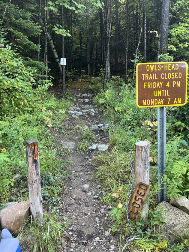
The Owl's Head trailhead is seen on Monday, Aug. 25 in the town of Keene. The trail, which is on private land, is closed from 4 p.m. Friday until 7 a.m. Monday, with public access allowed outside of those hours. (News photo — Chris Gaige)
To get there from the intersection of state Route 86 and state Route 73 in the village of Lake Placid, drive just over 11 miles east toward Keene. At that point, Owl’s Head Lane, a dirt road, intersects on the right. Fair warning: the small road comes up quickly. Parking is available on a wide shoulder off of state Route 73 just beyond Owl’s Head Lane.
Parking is limited and signs advise that no trailhead parking is available on Owl’s Head Lane. While it’s typically not an issue during weekdays, if the lot is full — while not ideal, as they say — the mountain will still be there next time. From the parking along state Route 73, it’s a 0.2-mile dirt road walk to the start of the trail.
Though the trail is short — just over one mile in total — it’s a steady uphill that requires hikers to be in decent physical shape. The climb begins immediately from the parking area as the trail makes its way through a shady pine forest.
The trail shows some signs of erosion, and hikers should be careful of exposed roots and rocks in the path — while taking care to stay on the trail and not worsen the situation.
Just before 0.1 miles, there is a switchback and a very short reprieve in the climb before it begins again. The first of several lookouts comes in at around 0.13 miles, jutting off to the right while the trail continues up to the left. It’s a good spot to take a rest if needed and while the views here are nice, they only get better as the trail heads further up.
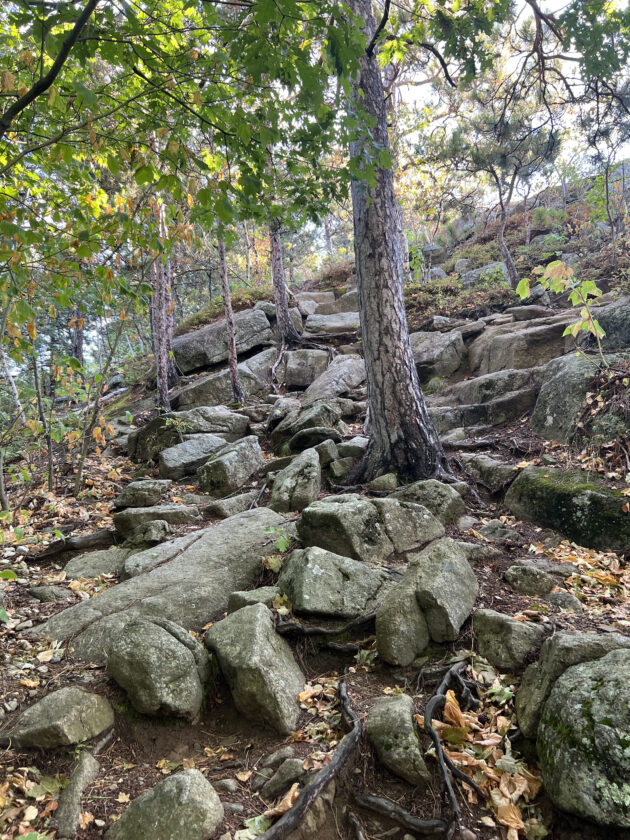
A steep and rocky stretch of trail is seen just before the summit of Owl's Head in the town of Keene on Monday, Aug. 25. (News photo — Chris Gaige)
The next lookout comes in around 0.25 miles, again on the right, with the trail cutting back left to another brief flat stretch before ratcheting up once again.
Just past 0.3 miles, the trail begins climbing out of the denser forest, oscillating between exposed rock and smaller patches of trees as the scenic vistas become increasingly abundant. The trail can be a bit difficult to navigate here, as there are no markers and there are several “splinter paths” through the scrub. For the most part, they end up in the same place, though in a couple of instances, the path I followed was a dead-end. With a simple backtrack and hop over to the next path, I found myself back on track.
Around 0.45 miles, the trail comes to a large rockface with 90-degree cliffs. For a brief moment, my heart sank and adrenaline rushed as I wondered if the trail would require a cliff scramble. As someone not well-versed in rock climbing, I wondered if I would have to turn around before the summit? Fortunately, the trail wound around to the left skirted around the cliffs with a much more gradual ascent on their back side.
The trail comes to the summit area around 0.5 miles, having gained about 500 feet in elevation from the parking lot. The summit has ample flat rockface, proving an ideal spot for a lunch break or leg stretch. For such a short hike, the views are expansive. For such a relatively short hike, it’s one of the most impressive views in the Olympic Region, in my opinion.
It’s not a 360-degree summit, instead offering approximately 270-degree views to the east, south and west, with limited views north poking through the trees in places.
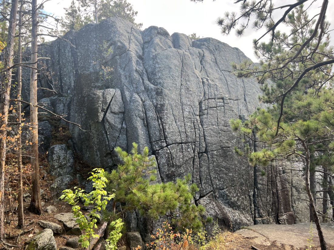
A cliff is seen near the Owl's Head summit in the town of Keene on Monday, Aug. 25. The trail bypasses the rock wall and winds around to the left, providing hikers a much easier path up to the summit area. (News photo — Chris Gaige)
Prominent features include Hurricane Mountain and its summit firetower, several Adirondack High Peaks: Giant, Porter, Cascade mountains and nearby Pitchoff Mountain. Between the peaks, portions of the Keene Valley can be seen to the south and Cascade Pass to the west, with state Route 73 winding between the two.
After taking the views in, I made my way back down and was back at the car in 40 minutes, including time stopped for photos and breaks. The round-trip distance was just over one mile.
Taking a gentle pace, the hike could reasonably be completed with an hour or so of time budgeted. Owl’s Head makes for a spectacular hike, especially for those looking for a shorter hike or who don’t have a large block of time. Once again, the trail is limited to weekdays and hikers should be respectful of the private property the trail runs through.

A panoramic view looking from south to west from the Owl's Head summit in the town of Keene is seen on Monday, Aug. 25. Prominent mountains, from left, include Hurricane, Giant, Cascade and Pitchoff mountains. Big Slide and Cascade mountains are both Adirondack High Peaks and Hurricane has a fire tower at its summit. (News photo — Chris Gaige)
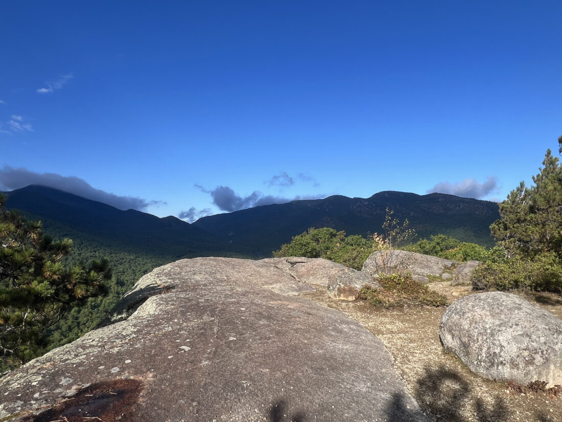
An expansive summit on Owl's Head provides ample space for a lunch or rest break in the sun on Monday, Aug. 25. In the background is the shoulder of Cascade Mountain, left, and Pitchoff Mountain. (News photo — Chris Gaige)
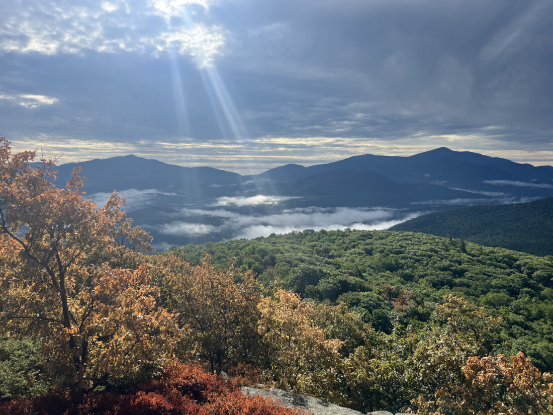
The Keene Valley is seen looking to the south from a scenic vista on the Owl's Head trail in the town of Keene on Monday, Aug. 25. The two tallest mountains in the background are Hurricane Mountain, left, and Giant Mountain -- an Adirondack High Peak. (News photo — Chris Gaige)


