Explaining the Great North American Eclipse on April 8
- Map by NASA
- The state Olympic Regional Development Authority is hosting eclipse watching at all of its venues — including here at the Olympic Speedskating Oval — on Monday, April 8. (News photo — Andy Flynn)
- A total solar eclipse is seen on Aug. 21, 2017 above Madras, Oregon. (Provided photo — NASA/Aubrey Gemignani)

A total solar eclipse is seen on Aug. 21, 2017 above Madras, Oregon. (Provided photo — NASA/Aubrey Gemignani)
LAKE PLACID — Bracing for an atypical Adirondack mud season — with visitor numbers usually seen in the summer season — the Regional Office of Sustainable Tourism and local communities have been preparing for the April 8 total solar eclipse for the past year. Now, the big event is just about here.
Those preparations have included launching a website — www.2024-eclipse.com — offering visitor information about the solar eclipse; and listing 2024 Solar Eclipse Business and Community Resources on the ROOST website — roostadk.com/eclipse2024 — that include planning tools and advice for local communities and businesses who wanted to hold eclipse-viewing events and visitor information.
ROOST also held a series of community calls about the eclipse, with the final one being held on Thursday, March 28. Topics discussed included viewing areas and events, visitation and traffic, preparation tips and communication.
–
2024 solar eclipse

The state Olympic Regional Development Authority is hosting eclipse watching at all of its venues — including here at the Olympic Speedskating Oval — on Monday, April 8. (News photo — Andy Flynn)
–
On April 8, as explained on the NASA website, a total solar eclipse will cross North America.
“A total solar eclipse happens when the moon passes between the sun and Earth, completely blocking the face of the sun,” NASA states. “The sky will darken as if it were dawn or dusk.”
First touching down in northern Mexico, totality’s shadow will darken the skies in parts of 13 U.S. states and six Canadian provinces (Ontario, Quebec, New Brunswick, Prince Edward Island, Nova Scotia and Newfoundland).
According to Space.com, the eclipse will first hit land about 370 miles off Mexico’s west coast on Isla Socorro. Mazatlan, Mexico, will be the first piece of the mainland to see totality. After Mazatlan, the eclipse will travel over Durango, Torren and Monclova, reaching the U.S. border at Piedras Negras.

The total solar eclipse will be moving northeast across the United States for a little over an hour, crossing the Mexico border into Texas around 2:28 p.m. and entering Canada from Maine around 3:32 p.m. In Lake Placid, the total solar eclipse will start around 3:25 p.m. — with maximum sun blockage around 3:26 p.m. — and will end around 3:28 p.m. Texas, Oklahoma, Arkansas, Missouri, Illinois, Kentucky, Indiana, Ohio, Pennsylvania, New York, Vermont, New Hampshire and Maine will witness totality.
The solar eclipse — from first contact to the end — will last about 2 hours and 23 minutes in the village of Lake Placid, according to NASA. But the length of totality in the Adirondack Park will be less than 4 minutes along its path. In Lake Placid, first contact will be around 2:13 p.m., and the eclipse will be over around 4:36 p.m. Totality in Lake Placid will last 3 minutes, 16 seconds — 3:25:05 to 3:28:21 p.m.
By comparison, the longest duration of totality on April 8 will be 4 minutes, 28 seconds, near Torren, Mexico, according to NASA.
The April 8 eclipse will be the last total solar eclipse visible from the contiguous United States until 2044. On March 30, 2033, there will be a total solar eclipse over Alaska and Russia.
–

Map by NASA
Path of totality
–
Moving from southwest to northeast, the center line of the total solar eclipse path on April 8 just means that’s where totality lasts the longest.
The path itself is about 115 miles wide, and people will experience totality north and south of the center line.
In the Adirondack Park, that means the following communities are within the path of totality: Lake Placid, Saranac Lake, Tupper Lake, Wilmington, Jay/Upper Jay, AuSable Forks, Keene/Keene Valley, Elizabethtown, Ray Brook, Bloomingdale, Paul Smiths, Vermontville, Piercefield, Star Lake, Cranberry Lake, Long Lake, Newcomb, Old Forge, Inlet, Raquette Lake, Blue Mountain Lake, Indian Lake, Minerva, North Hudson, Schroon Lake, Crown Point, Westport, Essex, Willsboro and Keeseville.
Outside the edge of totality, people will witness a partial solar eclipse, including the Adirondack communities of North Creek, Speculator, Northville, Warrensburg, Chestertown, Warrensburg and Ticonderoga.
–
Center path of totality
–
In all, the center line of totality will move through 12 towns and three counties inside the Adirondack Park: six towns in St. Lawrence County, four in Franklin County and two in Clinton County.
¯ Entering the Adirondack Park: The center of totality will first enter the Adirondack Park’s Blue Line in the west, in the St. Lawrence County town of Pitcairn after making a direct hit through downtown Harrisville (outside the park) in Lewis County. Continuing in a northwesterly projection, the center line moves out of the Blue Line briefly and then re-enters the park in the town of Fine, crossing state Route 3 north of Star Lake. Then it moves through portions of he towns of Clifton and Clare.
¯ Entering the Tri-Lakes: The center first enters the greater Tri-Lakes region as it crosses Route 56 just north of Seveys Corners in the town of Colton, northwest of Childwold, before moving into the town of Hopkinton.
¯ Entering Franklin County: The center line then moves into Franklin County in the town of Waverly and crosses into the town of Santa Clara just northwest of Bay Pond. It enters the town of Brighton after moving between Quebec Pond and Follensby Junior Pond, making a direct hit at Chain Lake before crossing state Route 30 north of Paul Smiths. After entering the town of Franklin, the center line continues northeasterly just north of Lake Kushaqua and then makes a direct hit at Loon Lake.
¯ Entering Clinton County: After leaving the town of Franklin, the center line of totality moves into the Clinton County town of Saranac and makes a direct hit on the Saranac Middle-High School before crossing state Route 3.
¯ Leaving the Adirondack Park: The center line of totality leaves the town of Saranac and briefly enters the town of Schuyler Falls before going outside the Blue Line and through the center of Cadyville in the town of Plattsburgh. Then it brushes through West Plattsburgh and continues to Point au Roche State Park on Lake Champlain before moving into northwest Vermont.
–
Stages of a total solar eclipse
–
On its Frequently Asked Questions page about the 2024 total solar eclipse, NASA explains the following stages as it progresses from first contact until he end.
¯ Partial eclipse: As the moon passes between the sun and Earth, at first it does not completely cover the sun. The sun appears to have a crescent shape.
¯ Shadow bands: Shadow bands are rapidly moving, long, dark bands separated by white spaces that can be seen on the sides of buildings or the ground just before and after totality, though they can be very faint and difficult to photograph.
¯ Baily’s Beads: As the moon continues to move across the sun, several points of light shine around the moon’s edges. Known as Baily’s Beads, these are light rays from the sun streaming through the valleys along the moon’s horizon.
¯ Diamond Ring: Baily’s Beads will begin to disappear until eventually, only a single bright spot will remain along the edge of the moon’s shadow. This bright spot resembles the diamond in a giant diamond ring formed by the rest of the sun’s atmosphere.
¯ Totality: Totality is when the moon completely blocks the bright face of the sun. This is the only stage of the eclipse that you can view with your naked eye. This stage can also reveal the chromosphere (a region of the solar atmosphere, appearing as the thin circle of pink around the moon) and the corona (the outer solar atmosphere, appearing as streams of white light).
¯ After totality, viewers will be able to experience the features they saw earlier in the eclipse again.
For more information about the April 8 total solar eclipse, visit science.nasa.gov/eclipses/future-eclipses/eclipse-2024.
Local News
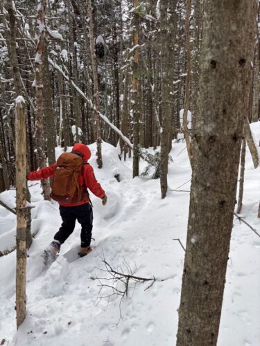
VISITING LAKE PLACID : A different world: A winter climb up Mount Colden
KEENE — My heart pounded, not from the 2,500 or so feet we had ascended over the last couple of hours, but for ...
Forest ranger recalls saving hiker lost for two days in Dix Range
Snowshoer found dead in lean-to in Pharaoh Lakes Wilderness
SCHROON — A Florida man was found dead in a lean-to in the 44,400-acre Pharaoh Lakes Wilderness in southern Essex ...

Ad’k Life announces photography contest winners
Some see Olympic blueprint for a 3rd Lake Placid games
CORTINA D’AMPEZZO, Italy — Imagine: A sprawling world-class city and a small mountain village with a rich ...