Meteorologists mark record warmth this winter in Adirondacks

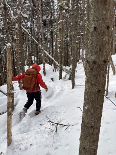
Due to warm temperatures earlier this week, puddles had formed around the base of the Lake Placid Toboggan Chute on Mirror Lake when this photo was taken on Wednesday, Feb. 28. (News photo — Sydney Emerson)
SARANAC LAKE — Tuesday was the hottest Feb. 27 on record in Saranac Lake, according to meteorologists, and the mercury was getting a workout, with a rapid 42-degree warmup that morning and another fast turn to freezing temperatures predicted for Wednesday night throughout the Adirondack Park.
With the fluctuating temperatures this week, meteorologists were forecasting potential flooding along the AuSable River on Wednesday and ice conditions on the roads on Thursday.
Jessica Neiles, a meteorologist with the National Weather Service in Burlington, Vermont, said Tuesday that a warm and dry air mass was in place ahead of a strong cold front, but the cold won’t last.
It’s supposed to be closer to seasonal temperatures on Thursday, Neiles said, but by Friday it is supposed to warm back up above normal. This warmth is projected to last through the weekend.
–
Record temperatures
–
The previous record high temperature for Feb. 27 in Saranac Lake’s 121-year record was 59 degrees in 2000, according to Neiles. The NWS’ records indicate that temperatures hit 60 between 1 and 3 p.m. on Tuesday.
“All of our climate sites have a new record high temperature today,” Neiles said on Tuesday. “It’s the warmest it’s been in over 20 years.”
All the previous NWS-Burlington records for that day were set in the year 2000. The previous record was 62 in Massena, St. Lawrence County, in the year 2000. It was 67 degrees there on Tuesday.
The change for the very unseasonable weather came on quickly. The NWS-Burlington singled out Saranac Lake in a post on X on Tuesday, the social media platform formerly known as Twitter.
“In a matter of three hours, Saranac Lake has risen from 18 to 53 degrees,” the post reads.
This change happened between 6:55 and 9:51 a.m.
“It’s crazy,” Neiles said.
Tuesday’s rapid temperature change won’t be the last one this week.
“It’s probably going to be similar in the other direction on Wednesday night,” she added.
These warm and cold fronts have a sharp temperature gradient, she said.
Through the warm front, record high temperatures are predicted again on Wednesday, Neiles added.
The high temperature record for Feb. 28 in Saranac Lake is 55. The NWS recorded a high of 57 Wednesday at the Adirondack Regional Airport in Lake Clear.
The weather forecast in Lake Placid predicted a high of 14 for Thursday, low of 9 Thursday night, high of 38 Friday, high of 46 Saturday and highs in the 50s Sunday through Wednesday.
–
Weather patterns
–
Paul Smith’s College natural science professor Curt Stager said the Adirondacks have always had mild winters and mid-winter thaws. Those are normal. What is unusual is the length and intensity of these warm spells recently, he said. He said these trends will continue as long as humans pollute the planet with greenhouse gasses, which trap heat on the earth.
The only way to stop this, he said, is to switch from powering civilization on fossil fuels to non-polluting energy sources.
“The faster we do it, the less warming we’re going to have,” Stager said. “But some warming is already baked into the system.”
This past December was the second warmest December on record in the Adirondacks, according to Stager. The warmest December was in 2015. Saranac Lake’s meteorological records date back to 1903.
Last year as a whole was the second-warmest year on record in the Adirondacks, tied with 1998 — 2012 was the warmest.
More severe weather translates to more damage to property and a larger impact on quality of life.
This past summer, Canadian wildfires sparked by lightning strikes burned hundreds of thousands of acres of land and cast a thick haze of smoke down through the United States. Severe flooding in July tore through the Long Lake area, destroying roads, bridges and homes. In December, warmth and rain brought winter flooding along the AuSable River in Keene and Jay and in Tupper Lake.
An unseasonably warm winter made for a slow start to this skiing season, led to ice fishing derbies around the Tri-Lakes being cancelled throughout the last month and melted the Saranac Lake Winter Carnival Ice Palace by the second weekend of festivities.
“This is record-breaking warmth for northern New York,” Neiles said. “It’s pretty likely we’re going to record the warmest winter on record.”
Meteorological winter spans the months of December, January and February, and though it won’t end until after Feb. 29, Neiles said even with Thursday’s cold temperatures, this will still likely set the record.
Globally, 2023 was the hottest year on record. January broke the global record for being the warmest January on record, being 2.74-degrees warmer than pre-industrial levels. The previous record was set in 2020.
National meteorologists and studies chalk the warm weather up to three things: Warm air jet streams “blasting” warm air from the south into the north; climate change, which has altered the routes of these jet streams; and the El Nino weather pattern, which also impacts jet streams, the Associated Press reported this week.
Local News
VISITING LAKE PLACID : A different world: A winter climb up Mount Colden
KEENE — My heart pounded, not from the 2,500 or so feet we had ascended over the last couple of hours, but for ...
Forest ranger recalls saving hiker lost for two days in Dix Range
Snowshoer found dead in lean-to in Pharaoh Lakes Wilderness
SCHROON — A Florida man was found dead in a lean-to in the 44,400-acre Pharaoh Lakes Wilderness in southern Essex ...
Ad’k Life announces photography contest winners
Some see Olympic blueprint for a 3rd Lake Placid games
CORTINA D’AMPEZZO, Italy — Imagine: A sprawling world-class city and a small mountain village with a rich ...